
Elevation 384 m Parent range Monts d'Arrée | ||
 | ||
Similar Mont Saint‑Michel de Brasp, Roc'h Ruz, Ménez‑Hom, Mont des Avaloirs, Rock of Oëtre | ||
Sweat lodge vs conne action roc h trevezel
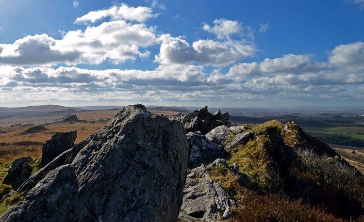
Roc'h Trevezel is the second peak of the Breton part of the Armorican Massif in the Monts d'Arrée. Just like the Signal of Toussaines, it reaches 384 metres (1,260 ft) in altitude. It is located in the commune of Plounéour-Ménez, near Roc'h Ruz, the highest point of the Monts d'Arrée in Brittany.
Contents
- Sweat lodge vs conne action roc h trevezel
- Map of Roch Trevezel 29410 PlounC3A9our MC3A9nez France
- Monts d arr e roc h trevezel vue panoramique
- References
Map of Roc'h Trevezel, 29410 Ploun%C3%A9our-M%C3%A9nez, France
Roc'h Trevezel is the highest peak on the Paris–Brest–Paris bicycle route.
Monts d arr e roc h trevezel vue panoramique
References
Roc'h Trevezel Wikipedia(Text) CC BY-SA