
Congr. district 2nd district Barangays Area 1,256 km² | Founded April 14, 1983 Time zone PST (UTC+8) Area code 48 Dialling code 48 | |
 | ||
Neighborhoods Canipaan, Banua, Sarimog, Eran, Conduaga, Bulaloe, Summerumsum, Malabangan | ||
Rizal palawan philippines 2013
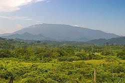
Rizal, officially the Municipality of Dr. Jose P. Rizal, is a first class municipality in the province of Palawan, Philippines. According to the 2010 census, it has a population of 42,759 people.
Contents
- Rizal palawan philippines 2013
- Map of Rizal Palawan Philippines
- Rizal palawan
- Barangays
- Demographics
- References
Map of Rizal, Palawan, Philippines
Prior to its formation as a separate municipality, the place was known as Tarumpitao Point and was part of the Municipality of Quezon. By virtue of Batas Pambansa Blg. 386, it was formed as a municipality on April 14, 1983, called Marcos. It was renamed after José Rizal in 1987 through Republic Act No. 6652.
Safety and Well-Being must be considered when trying to travel this area because the place has a very high incidence of malaria.
Rizal palawan
Barangays
Rizal is politically subdivided into 11 barangays.
Demographics
Among the ethnic groups in Rizal are the Tao't Bato people. These people settle in caves during the rainy season and resides at Singnapan Valley area in Barangay Ransang.