
GNIS feature ID 1507825 Population 6,407 (2010) | Time zone Pacific (PST) (UTC-8) Area 3.061 km² | |
 | ||
Restaurants Buxx Teriyaki, Pho BT, Pho Teriyaki Wok, La Rielera LLC, Soul Food Heaven | ||
Riverton is a census-designated place (CDP) in King County, Washington, United States. The population was 6,407 at the 2010 census. Riverton was formerly part of the Riverton-Boulevard Park CDP, which was split up for the 2010 census into Riverton and Boulevard Park.
Contents
Map of Riverton-Boulevard Park, Seattle, WA, USA
Riverton also refers to a neighboring former community in part of what is now Tukwila in the Duwamish River Valley. It was on the left bank of the Duwamish, not far from the location on the right bank of the present-day Tukwila Community Center.
History
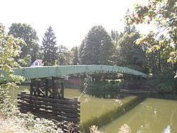
Riverton lent its name to an early 20th-century bridge, variously known as the Riverton Draw Bridge, the Riverton Drawspan, and King County Bridge 622-A. Built 1903, the bridge developed a reputation for being rather unsafe. It closed to vehicles 1919, and was demolished 1927. A remnant of the central pier can still be seen in the river as of 2009, visible either from the riverbank or from the 119th St. S. pedestrian bridge or the Allentown Bridge.
Geography
Riverton is located at 47°29′41″N 122°18′40″W (47.494614, -122.311248).
According to the United States Census Bureau, the CDP had a total area of 1.182 square miles (3.061 km²), of which, 1.182 square miles (3.061 km²) of it is land and 0.000 square miles (0.000 km²) of it (0%) is water.