
Country United Kingdom | ||
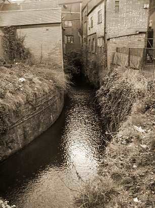 | ||
The River Sherbourne is a river that flows under the centre of the city of Coventry, in the West Midlands, in England.
Map of River Sherbourne, United Kingdom
The source of the river is in the fields near Hawkes End in the parish of Allesley. It flows for about 8 miles or 13 km in a generally SE direction. In the centre of Coventry it flows through Spon End (where it is spanned by Vignoles Bridge) and it is culverted just before it reaches the Inner Ring Road and Spon Street, and continues through the suburb of Whitley. It joins the River Sowe (a tributary of the River Avon) south of the A45 road near Baginton.
The name Sherbourne is said to derive from Scir Burna, "clear stream" in Old English.
In 1935 and on eight more recent occasions, the upper Sherbourne around Allesley has dried up almost completely.
Coventry City Council has plans to open up a stretch of the river which is currently culverted, and runs beneath The Burges, a street in the city centre.