
- elevation 120 m (394 ft) | - elevation 90 m (295 ft) | |
 | ||
- location Hungerford, Berkshire, United Kingdom | ||
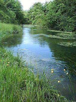
The River Dun is a tributary flowing through Wiltshire and Berkshire in England. Its main source is in the parish of Great Bedwyn, Wiltshire and it flows for its whole course ENE into Berkshire, where it discharges into the River Kennet at Hungerford, which is upstream of that point of a smaller average flow and width.
Map of River Dun, United Kingdom
The Dun valley is an important transport route through the high chalklands between the London Basin to the east and the Vale of Pewsey to the west. It is the route by which the Kennet and Avon Canal (linking London and Bristol) enters the Thames basin from the Vale of Pewsey, crossing the watershed with the aid of the Bruce Tunnel and Crofton Pumping Station. The later Reading to Plymouth railway linking London and the south-west also uses the valley.