
County San Joaquin Time zone PST (UTC-8) Elevation 21 m Population 14,754 (2013) | State California Incorporated November 27, 1945 Area code(s) 209 Zip code 95366 Local time Thursday 9:07 AM | |
 | ||
Weather 14°C, Wind W at 32 km/h, 67% Humidity | ||
Workflow 1 ripon california
Ripon is a city located in San Joaquin County, California. The population was 14,297 at the 2010 census.
Contents
- Workflow 1 ripon california
- Map of Ripon CA 95366 USA
- History
- Geography
- 2010
- 2000
- Education
- Schools
- Notable people
- References
Map of Ripon, CA 95366, USA
History
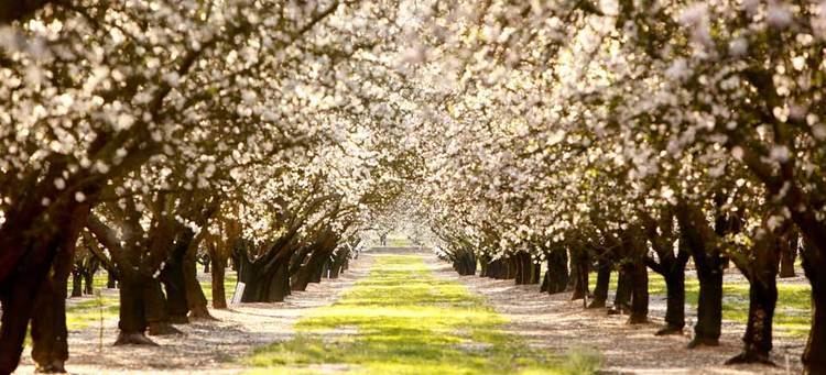
Ripon, on the site previously known as Murphy's Ferry, Stanislaus City, & Stanislaus Station, was renamed for Ripon, Wisconsin, which was itself named for a city in North Yorkshire, England. Ripon's economy is largely agriculture based, known especially for its high almond production.
Geography
Ripon is located at 37°44′26″N 121°07′42″W (37.740478, -121.128224).
According to the United States Census Bureau, the city has a total area of 5.5 square miles (14.2 km2), of which, 5.3 square miles (13.7 km2) of it is land and 0.2 square miles (0.5 km2) of it (3.47%) is water.
2010
The 2010 United States Census reported that Ripon had a population of 14,297. The population density was 2,601.8 people per square mile (1,004.5/km²). The racial makeup of Ripon was 11,392 (79.7%) White, 221 (1.5%) African American, 125 (0.9%) Native American, 599 (4.2%) Asian, 36 (0.3%) Pacific Islander, 1,208 (8.4%) from other races, and 716 (5.0%) from two or more races. Hispanic or Latino of any race were 3,177 persons (22.2%).
The Census reported that 14,207 people (99.4% of the population) lived in households, 0 (0%) lived in non-institutionalized group quarters, and 90 (0.6%) were institutionalized.
There were 4,855 households, out of which 2,057 (42.4%) had children under the age of 18 living in them, 3,099 (63.8%) were opposite-sex married couples living together, 472 (9.7%) had a female householder with no husband present, 227 (4.7%) had a male householder with no wife present. There were 193 (4.0%) unmarried opposite-sex partnerships, and 20 (0.4%) same-sex married couples or partnerships. 896 households (18.5%) were made up of individuals and 437 (9.0%) had someone living alone who was 65 years of age or older. The average household size was 2.93. There were 3,798 families (78.2% of all households); the average family size was 3.34.
The population was spread out with 4,119 people (28.8%) under the age of 18, 1,210 people (8.5%) aged 18 to 24, 3,469 people (24.3%) aged 25 to 44, 3,811 people (26.7%) aged 45 to 64, and 1,688 people (11.8%) who were 65 years of age or older. The median age was 37.1 years. For every 100 females there were 95.8 males. For every 100 females age 18 and over, there were 92.3 males.
There were 5,129 housing units at an average density of 933.4 per square mile (360.4/km²), of which 3,530 (72.7%) were owner-occupied, and 1,325 (27.3%) were occupied by renters. The homeowner vacancy rate was 1.6%; the rental vacancy rate was 7.4%. 10,574 people (74.0% of the population) lived in owner-occupied housing units and 3,633 people (25.4%) lived in rental housing units.
2000
As of the census of 2000, there were 10,146 people, 3,368 households, and 2,680 families residing in the city. The population density was 2,473.5 people per square mile (955.5/km²). There were 3,446 housing units at an average density of 840.1 per square mile (324.5/km²). The racial makeup of the city was 84.52% White, 0.34% African American, 0.61% Native American, 1.51% Asian, 0.28% Pacific Islander, 8.80% from other races, and 3.94% from two or more races. Hispanic or Latino of any race were 18.16% of the population.
There were 3,368 households out of which 45.5% had children under the age of 18 living with them, 66.1% were married couples living together, 9.6% had a female householder with no husband present, and 20.4% were non-families. 16.9% of all households were made up of individuals and 7.8% had someone living alone who was 65 years of age or older. The average household size was 2.98 and the average family size was 3.37.
In the city, the population was spread out with 32.0% under the age of 18, 7.6% from 18 to 24, 29.4% from 25 to 44, 20.9% from 45 to 64, and 10.1% who were 65 years of age or older. The median age was 34 years. For every 100 females there were 93.8 males. For every 100 females age 18 and over, there were 90.4 males.
The median income for a household in the city was $56,979, and the median income for a family was $62,592. Males had a median income of $47,377 versus $25,389 for females. The per capita income for the city was $20,978. About 4.7% of families and 6.2% of the population were below the poverty line, including 6.2% of those under age 18 and 11.5% of those age 65 or over.
Education
Students are served by five K–8 elementary schools (self-contained at all grade levels), and one high school by Ripon Unified School District, located in the Central Valley. All schools have API scores above 700. Three of the elementary schools have API scores above 800.