
Population 1,024 (2011) State electorate(s) IpswichBundamba Postal code 4306 | Postcode(s) 4306 | |
 | ||
Location 41 km (25 mi) from Brisbane8 km (5 mi) from Ipswich | ||
Ripley is a suburb of Ipswich, Queensland, Australia. At the 2011 Australian Census the suburb recorded a population of 1,024. The eastern boundary of Ripley is aligned with Bundamba Creek. The Centenary Highway passes through the south east corner of Ripley.
Contents
Map of Ripley QLD 4306, Australia
Ripley is the eponym of the valley which the suburb is located within titled Ripley Valley.
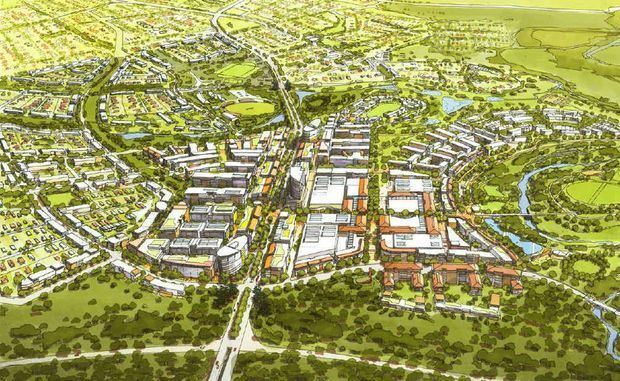
Ripley urban development
Ripley in its current form exists as a small community of under 1,000 residents. The area is part of the Brisbane metropolitan western growth corridor project. The development, known as Ecco Ripley is in response to the local and state governments solicitation for land releases to alleviate expected and forecasted population growth from the general population growth of the existing communities as well as growth from interstate and overseas migration.
Once the area is fully developed, Ripley is expected to have a population of 120,000 people with an estimated 50,000 residential dwellings. The city development will provide employment with 200,000 job positions estimated. The Ripley development takes advantage of the suburbs and areas within the western growth corridor such as Amberley, Ebenezer, New Chum, Swanbank, Deebing Heights and Willowbank with suitable land for new business and industrial developments.
The development is to be the country's largest planned community.