
- elevation 9,957 ft (3,035 m) - elevation 7,287 ft (2,221 m) Mouth Chama River | Basin area 388.5 km² | |
 | ||
- left Gavilan Creek, Encinado Creek - right Barrow Canyon, Chavez Creek - location Brazos Meadows, San Juan Mountains | ||
The Rio Brazos is a 42-mile (68 km) long river flowing through northern New Mexico in the United States. It rises in the Tusas Mountains, a subrange of the San Juan Mountains, and runs generally southwest to a confluence with the Rio Chama, part of the larger Rio Grande system.
The river is formed by two streams, the 8.74-mile (14.07 km) West Fork and the 8.44-mile (13.58 km) East Fork, which converge at Brazos Meadows, just outside the western boundary of the Carson National Forest. For its first few miles, it flows south as a slow-moving, meandering mountain stream. East of Brazos Peak, it swings abruptly west into the Brazos Box, one of the largest canyons in New Mexico with a maximum depth of more than 1,400 feet (430 m). Here, it passes the Brazos Cliffs, receives Gavilan and Encinado Creeks, and picks up an unnamed tributary which feeds Brazos Falls, reputedly New Mexico's highest waterfall with a total drop of 2,400 feet (730 m). Northeast of Tierra Amarilla, the river emits from the mountains, receiving Chavez Creek from the right. It passes the settlements of Ensenada, Brazos and Los Ojos before flowing into the Rio Chama about 90 miles (140 km) northwest of Santa Fe.
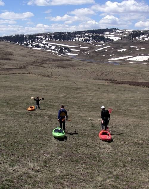
The Brazos is a perennial stream, reaching its highest flows in April and early May from snowmelt in the mountains, and is subject to occasional flash floods caused by summer thunderstorms. Although most of the river's length provides good fishing for brown and rainbow trout, especially the upper section which is one of the largest high-meadow streams in New Mexico, most of the drainage is private property making it largely inaccessible for recreation.
Although most of the Brazos flows through wild lands, the river is heavily used for irrigation in the last 5 miles (8.0 km), with multiple acequias (irrigation ditches) drawing off water. As a result, this section of the river often shrinks to a trickle during the dry season. The U.S. Environmental Protection Agency lists the water quality for the last 3.52 miles (5.66 km) of the river as "impaired", owing mainly to agricultural runoff and heavy summer water diversions.