
Built 1931 Architectural style Other Opened 1931 Nearest city Grand Junction | Architect NPS NRHP Reference # 94000310 Added to NRHP 21 April 1994 | |
 | ||
Similar Colorado National Monument, Book Cliffs, Ute Canyon View, Red Canyon Overlook, Rattlesnake Canyon | ||
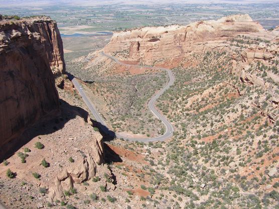
Rim Rock Drive is a scenic road in Colorado National Monument. The 23-mile drive follows the upper rim of a series of canyons, extending from the vicinity of Fruita, Colorado in the west to near Grand Junction, Colorado in the east, connecting points only eight miles apart in a straight line. The entire road has been designated a historic district on the National Register of Historic Places.
Map of Rimrock Dr, Colorado, USA
The routing of the road was determined in November 1931 by National Park Service Engineer Thomas W. Secrest during a visit to the monument.
The detailed design for the road was developed in 1932 by the National Park Service Branch of Engineering and Branch of Plans and Design for maximum scenic impact, using the National Park Service Rustic style. Most of the road was constructed with almost entirely manual labor by labor from the Works Progress Administration, Public Works Administration and Civilian Conservation Corps, and represents one of the most significant Depression-era public projects. Extensive drilling and blasting was required, and three tunnels were bored. Work was suspended by the Second World War from 1942 to 1948, and was finally completed in 1950. At its height, the project employed more than 800 men.