
Country United States City New York City Founded 1868 | State New York County/Borough Queens Named for Edward Richmond | |
 | ||
Restaurants Singh's Roti Shop & Bar, Veggie Castle II, Caribbean Cabana, Chimi Mundo, Atlantic Diner | ||
muninyc lefferts boulevard liberty avenue richmond hill queens 11419
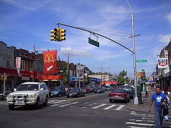
Richmond Hill is a racially and culturally integrated urban neighborhood in southwestern Queens County, a borough of New York City. It abuts Kew Gardens (North), Jamaica (East), Ozone and South Ozone Park (South), and Woodhaven (West). The neighborhood is split between Queens Community Board 9 and 10. Main commercial streets in the neighborhood include Jamaica Avenue, Atlantic Avenue and Liberty Avenue; Richmond Hill is home to a density of Christian churches (both major denominations and storefront), Sikh centers, Hindu temples, Jewish synagogues and mosques.
Contents
- muninyc lefferts boulevard liberty avenue richmond hill queens 11419
- Map of Richmond Hill Queens NY USA
- Location
- History
- Housing
- Landmarks
- Demographics
- Media
- Parks and recreation
- Libraries
- Schools
- Notable residents
- References
Map of Richmond Hill, Queens, NY, USA
Richmond Hill is known as Little Guyana, for its large Guyanese immigrant population, as well as Little Punjab, for its large Punjabi immigrant population.
Many residents own their own homes, and some rent out apartments in them. There are also some small apartment buildings. Commercial strips along Jamaica and Liberty Avenue contain mixed use buildings. Atlantic Avenue is commercial. A Long Island Railroad spur and yard provides freight access for business at Jamaica Avenue and Lefferts Boulevard. The ZIP code for Richmond Hill is 11418 and for South Richmond Hill it is 11419.
Location
Richmond Hill is located between Kew Gardens and Forest Park to the north, Jamaica and South Jamaica to the east, South Ozone Park to the south, and Woodhaven and Ozone Park to the west. Hillside Avenue forms its northern boundary with Kew Gardens east of Lefferts Boulevard, while Forest Park and the right-of-way of the Long Island Rail Road (LIRR)'s Montauk Branch form its northern edge west of Lefferts. Its western boundary north of Atlantic Avenue is formed by the LIRR's abandoned Rockaway Beach Branch; south of Atlantic, the western border lies between 104th and 107th Streets. The southern border extends to around 103rd Avenue or Liberty Avenue. The Van Wyck Expressway abuts the eastern end of the community. The portion of the neighborhood south of Atlantic Avenue is also known as South Richmond Hill.
History
The hill referred to as Richmond Hill is a moraine created by debris and rocks collected while glaciers advanced down North America during the Wisconsin glaciation. Prior to European colonization, the land was occupied by the Rockaway Native American group, for which the Rockaways were named. In 1660, the Welling family purchased land in what was then the western portion of the colonial town of Rustdorp. The land would become the Welling Farm, while Rustdorp would be renamed Jamaica under British rule in 1664. The Battle of Long Island, one of the bloodiest battles of the Revolutionary War, was fought in 1776 along the ridge in present-day Forest Park, near what is now the golf course clubhouse. Protected by its thickly wooded area, American riflemen used guerrilla warfare tactics to attack and defeat the advancing Hessians. One of the sites that would make up modern Richmond Hill, Lefferts Farm, was said to be the site of a Revolutionary War battle. In January 1853, a Farming community was established on the south side of Jamaica Avenue between 110th and 112th Streets, known as Clarenceville. This land was purchased from the Welling estate.
Richmond Hill's name was inspired either by a suburban town near London or by Edward Richmond, a landscape architect in the mid-19th century who designed much of the neighborhood. In 1868, Albon Platt Man, a successful Manhattan lawyer, purchased the Lefferts, Welling, and Bergen farms along with other plots amounting to 400 acres of land, and hired Richmond to lay out the community. The tract extended as far north as White Pot Road (now Kew Gardens Road) near modern Queens Boulevard; The area reminded Man of the London suburb, where his family resided. Man's sons would later found the nearby Kew Gardens neighborhood from the northern portion of the land.
Streets, schools, a church, and a railroad were built in Richmond Hill over the next decade, thus making the area one of the earliest residential communities on Long Island. The streets were laid down to match the geography of the area. The development of area was facilitated by the opening of two railroad stations. These were the Clarenceville station on the Brooklyn and Jamaica Railroad, at Atlantic Avenue and Greenwood Avenue (now 111th Street); and the Richmond Hill station at Park Street (now Hillside Avenue) near Jamaica and Lefferts Avenues on the Montauk railroad line between Long Island City and eastern Long Island. By 1872, a post office was established in the neighborhood, while the Clarenceville neighborhood was merged into Richmond Hill. Richmond Hill was incorporated as an independent village in 1894, by which time it had also absorbed the Morris Park neighborhood, which had been established in 1885. In 1898, Richmond Hill and the rest of Queens county were consolidated into the City of Greater New York.
The BMT Fulton Street Line was extended east along Liberty Avenue into the area on September 25, 1915, terminating at Lefferts Avenue (now Lefferts Boulevard). The area received further development when the BMT Jamaica Line elevated was extended east into the neighborhood at Greenwood Avenue (now 111th Street) on May 28, 1917. As the neighborhood's population continued to grow into the 1920s, smaller closely spaced houses and apartment buildings began to replace large private houses.
Housing
The area is well known for its large-frame single-family houses, many of which have been preserved since the turn of the 20th century. Many of the Queen Anne Victorian homes of old Richmond Hill still stand in the area today.
Landmarks
The Triangle Hofbrau, opened as a hotel in 1893 and as a restaurant in 1893, was a restaurant which was frequented by such stars as Mae West in the 1920s and 1930s. It sat on the triangular piece of land bordered by Hillside Avenue, Jamaica Avenue, and Myrtle Avenue. The building has since been converted to medical offices. Near the northwest corner of Hillside Avenue and Myrtle Avenue sat an old time ice cream parlor, Jahn's. It closed in late 2007. Between Myrtle Avenue and the Montauk Line railroad is a former movie theatre, RKO Keith's Richmond Hill Theater, opened in 1929, functioning since 1968 as a bingo hall. These and several other landmarks are located in the vicinity of the "Richmond Hill Triangle", bracketed by Jamaica Avenue, Myrtle Avenue, and 117th Street. This was historically the commercial center of Richmond Hill. The intersection of Jamaica and Myrtle Avenues is also known as James J. Creegan Square.
The northern edge of Richmond Hill contains the Church of the Resurrection. This Episcopalian church is an 1874 structure and is the oldest house of worship in Richmond Hill. It was placed in the National Register of Historic Places in 2003. Also listed on the National Register of Historic Places are Public School 66 and Saint Benedict Joseph Labre Parish.
Demographics
Originally, many European families (Italian, Dutch, British, Irish, Scots, Danish, and German) lived in Richmond Hill. In the 1970s, the neighborhood was predominantly Hispanic. Today, the south side of Richmond Hill consists mostly of South Asian Americans (Indians and Bangladeshis) and Caribbean Americans (Trinidadians, Guyanese, and Jamaicans), who have steadily emigrated to the United States since the 1970s. Richmond Hill also has the largest Sikh population in the city.
Based on data from the 2010 United States Census, the population of Richmond Hill was 62,982, a decrease of 3 (0.0%) from the 62,985 counted in 2000. Covering an area of 1,171.55 acres (474.11 ha), the neighborhood had a population density of 53.8 inhabitants per acre (34,400/sq mi; 13,300/km2).
The racial makeup of the neighborhood was 11.2% (7,078) White, 11.1% (6,960) African American, 1.0% (657) Native American, 27.4% (17,252) Asian, 0.2% (116) Pacific Islander, 6.6% (4,139) from other races, and 6.6% (4,136) from two or more races. Hispanic or Latino of any race were 36.0% (22,644) of the population.
Media
WICR, 1620AM, broadcasts Indo-Caribbean programming from studios on Liberty Avenue in South Richmond Hill.
Parks and recreation
Libraries
Schools
Richmond Hill schools are operated by the New York City Department of Education.
Public elementary schools include:
Residents are zoned to MS 72.
Richmond Hill High School is located in the neighborhood. Until June, 2012, the city had planned to close the high school. The city had slated the school to close; however, a court ruling prevented the school's closure.
Private schools include: