
Primary outflows Redoubt falls Max. length 9 mi (14 km) Surface elevation 4.6 m Mean depth 140 m Width 1.6 km | Basin countries United States Max. width 1 mi (1.6 km) Area 12.95 km² Length 14.5 km | |
 | ||
Similar Baranof Lake, Mount Edgecumbe, Sitka National Historical, Chichagof Island, Kodiak National Wildlife R | ||
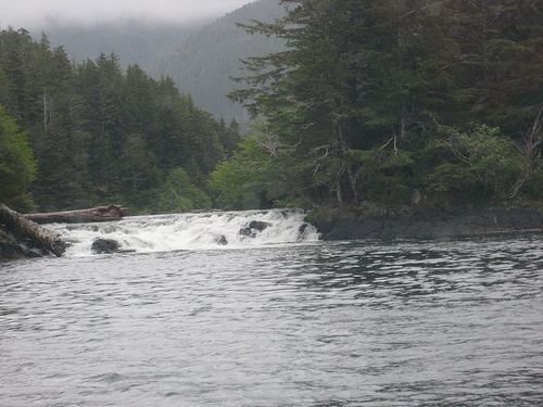
Redoubt Lake, or Kunaa Shak Áayi, is a long, narrow lake on Baranof Island, near Sitka, Alaska. It is located in a glacially-carved valley in Tongass National Forest. It was named Ozero Glubokoye, meaning "deep lake", in 1809 by the Russian navigator Ivan Vasilyev.
Map of Redoubt Lake, Sitka, AK 99835, USA
Redoubt Lake is one of the largest meromictic lakes in North America. Its water is fresh to a depth of 330 ft (100 m), below which is a dense, saltwater layer. The lake's maximum depth is 870 ft (270 m) with a mean depth of 460 ft (140 m). Its surface area covers 3,200 acres (13 km2).
In the early 19th century Redoubt Lake was part of Russian America. The Russians established a small settlement near the lake's outlet known variously as Ozersk Redoubt, Ozyorsk Redoubt, The Redoubt, Seleniye Dranishnikova, or Dranishnikov Settlement. Salmon traps were set in the lake and the catch was salted and dried at Ozersk Redoubt. Between 1817 and 1832 the Russians at Sitka and Ozersk Redoubt salted an average of 20,000 salmon annually.
Fish harvests by the Russians at Redoubt Lake sometimes exceeded 50,000 sockeye salmon per year. Annual escapements possibly exceeded 100,000 sockeye. In the 1980s, sockeye escapement or returns of adult fish had declined to an average less than 10,000 annually. Some years the numbers measured in the low hundreds.