
Elevation 1,310 m | ||
 | ||
Similar Tanque Verde Falls, Rincon Mountains, Douglas Spring Trailhead, Hutch's Pool, Mount Glenn | ||
Redington Pass (el. 1310 m./4300 ft.) is a high mountain pass between the Santa Catalina Mountains and the Rincons in northeast Pima County, Arizona. It is located just east of Tucson. Historically, it was the connection between the farming and ranching areas of Redington along the San Pedro River on the east side of the pass and Tucson on the west side.
Map of Redington Pass, Arizona 85641, USA
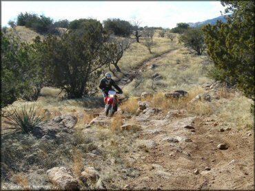
The road through Redington Pass is unpaved and the area throughout the pass is a favorite of mountain bikers and all-terrain vehicle riders. The area was also frequented by firearms enthusiasts, as the region contained three unofficial shooting range areas. As of 2013 these unofficial shooting ranges have been shut down by federal officials due to litter and noise pollution. The west side of the pass near Tanque Verde Falls affords beautiful views overlooking the east side of the city of Tucson, spread out across the Sonoran Desert floor below.
Recently Nov 21st, 2016 they allow shooting again, but I believe the police are trying to point people to shoot up between mile marker 8 and 9.