
Country United States FIPS code 04-59550 Elevation 1,635 m Zip code 86514 Area code 928 | Time zone MST (UTC-7) GNIS feature ID 0024578 Area 33.3 km² Population 480 (2010) | |
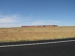 | ||
Red Mesa is a census-designated place (CDP) in Apache County, Arizona, United States. The population was 480 at the 2010 census.
Contents
- Map of Red Mesa AZ 86514 USA
- Geography
- Navajo Nation Red Mesa Council delegates
- Demographics
- Education
- Red Mesa Ancestral Pueblo pottery
- References
Map of Red Mesa, AZ 86514, USA
Geography
Red Mesa is located at 36°58′3″N 109°23′21″W (36.967367, -109.389234).
According to the United States Census Bureau, the CDP has a total area of 12.9 square miles (33.3 km2), all of it land.
Navajo Nation Red Mesa Council delegates
Demographics
As of the census of 2000, there were 237 people, 78 households, and 52 families residing in the CDP. The population density was 18.6 people per square mile (7.2/km²). There were 102 housing units at an average density of 8.0/sq mi (3.1/km²). The racial makeup of the CDP was 81.86% Native American, 10.97% White, 2.53% Pacific Islander, 2.11% from other races, and 2.53% from two or more races. 2.11% of the population were Hispanic or Latino of any race.
There were 78 households out of which 44.9% had children under the age of 18 living with them, 38.5% were married couples living together, 25.6% had a female householder with no husband present, and 32.1% were non-families. 29.5% of all households were made up of individuals and 5.1% had someone living alone who was 65 years of age or older. The average household size was 3.04 and the average family size was 3.94.
In the CDP, the age distribution of the population shows 37.6% under the age of 18, 8.9% from 18 to 24, 26.6% from 25 to 44, 20.3% from 45 to 64, and 6.8% who were 65 years of age or older. The median age was 28 years. For every 100 females there were 73.0 males. For every 100 females age 18 and over, there were 60.9 males.
The median income for a household in the CDP was $22,159, and the median income for a family was $22,159. Males had a median income of $25,357 versus $25,938 for females. The per capita income for the CDP was $6,836. About 33.3% of families and 43.5% of the population were below the poverty line, including 48.5% of those under the age of eighteen and 52.4% of those sixty five or over.
Education
The area is a part of the Red Mesa Unified School District. Red Mesa contains the district headquarters. Three district schools, Red Mesa Elementary School (RMES), Red Mesa Junior High School (RMJHS), and Red Mesa High School are in Red Mesa.
Originally the territory was within the Chinle School District. In July 1983 the Red Mesa Unified School District formed, splitting from the Chinle School District.
Red Mesa Ancestral Pueblo pottery
The Red Mesa prehistoric pottery type was named for this Arizona area. Made from about 950 to 1050 AD, it is a subdivision of Cibola Whiteware. Designs are usually banded and can be much busier than earlier types, but simple designs are also common. Pots are sually slipped (often chalky) and polished, but some examples not slipped and not well polished.