
Country United States FIPS code 19-65910 Area 85 ha Zip code 50668 Local time Saturday 1:11 PM | Time zone Central (CST) (UTC-6) GNIS feature ID 0460544 Elevation 315 m Population 821 (2013) Area code 319 | |
 | ||
Weather 4°C, Wind NE at 29 km/h, 95% Humidity | ||
2014 05 04 one person killed in apartment fire readlyn iowa myke goings kmdg
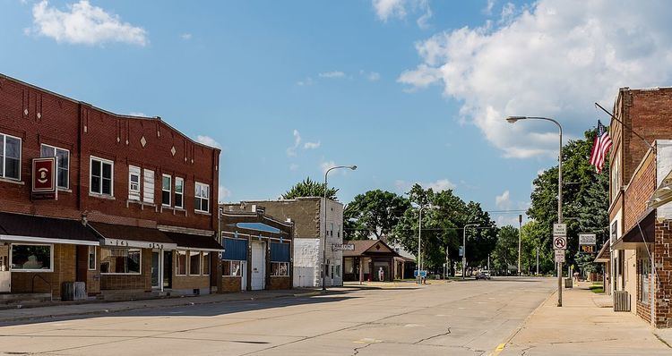
Readlyn is a city in Bremer County, Iowa, United States. The population was 808 at the 2010 census. It is part of the Waterloo–Cedar Falls Metropolitan Statistical Area.
Contents
- 2014 05 04 one person killed in apartment fire readlyn iowa myke goings kmdg
- Map of Readlyn IA 50668 USA
- Geography
- 2010 census
- 2000 census
- References
Map of Readlyn, IA 50668, USA
Geography
Readlyn is located at 42°42′12″N 92°13′35″W (42.703325, -92.226320).
According to the United States Census Bureau, the city has a total area of 0.33 square miles (0.85 km2), all of it land.
2010 census
As of the census of 2010, there were 808 people, 338 households, and 222 families residing in the city. The population density was 2,448.5 inhabitants per square mile (945.4/km2). There were 346 housing units at an average density of 1,048.5 per square mile (404.8/km2). The racial makeup of the city was 98.0% White, 0.5% African American, 0.1% Native American, 0.5% Asian, 0.6% from other races, and 0.2% from two or more races. Hispanic or Latino of any race were 1.2% of the population.
There were 338 households of which 34.0% had children under the age of 18 living with them, 57.7% were married couples living together, 5.6% had a female householder with no husband present, 2.4% had a male householder with no wife present, and 34.3% were non-families. 32.2% of all households were made up of individuals and 17.2% had someone living alone who was 65 years of age or older. The average household size was 2.39 and the average family size was 3.01.
The median age in the city was 37.8 years. 28.1% of residents were under the age of 18; 5% were between the ages of 18 and 24; 26.1% were from 25 to 44; 23.9% were from 45 to 64; and 16.7% were 65 years of age or older. The gender makeup of the city was 48.0% male and 52.0% female.
2000 census
As of the census of 2000, there were 786 people, 322 households, and 223 families residing in the city. The population density was 2,444.4 people per square mile (948.4/km²). There were 326 housing units at an average density of 1,013.8 per square mile (393.3/km²). The racial makeup of the city was 98.35% White, 0.38% African American, 0.13% Native American, 0.64% Asian, and 0.51% from two or more races. Hispanic or Latino of any race were 0.25% of the population.
There were 322 households out of which 32.9% had children under the age of 18 living with them, 60.6% were married couples living together, 6.5% had a female householder with no husband present, and 30.7% were non-families. 28.9% of all households were made up of individuals and 18.6% had someone living alone who was 65 years of age or older. The average household size was 2.44 and the average family size was 3.01.
27.7% were under the age of 18, 5.6% from 18 to 24, 24.8% from 25 to 44, 23.9% from 45 to 64, and 17.9% were 65 years of age or older. The median age was 39 years. For every 100 females there were 94.6 males. For every 100 females age 18 and over, there were 84.4 males.
The median income for a household in the city was $41,625, and the median income for a family was $52,308. Males had a median income of $32,313 versus $24,625 for females. The per capita income for the city was $17,721. About 2.4% of families and 2.7% of the population were below the poverty line, including 2.1% of those under age 18 and 5.3% of those age 65 or over.