
Country United States FIPS code 29-60824 Elevation 299 m Zip code 64084 Local time Saturday 7:17 AM | Time zone Central (CST) (UTC-6) GNIS feature ID 0730188 Area 65 ha Population 193 (2009) Area code 816 | |
 | ||
Weather 10°C, Wind NE at 3 km/h, 100% Humidity | ||
Showme ziplines 15510 highway c rayville missouri 64084
Rayville was a village in Ray County, Missouri, United States. The population was 223 at the 2010 census. It disincorporated in 2012.
Contents
- Showme ziplines 15510 highway c rayville missouri 64084
- Map of Rayville MO 64084 USA
- History
- Geography
- 2010 census
- 2000 census
- References
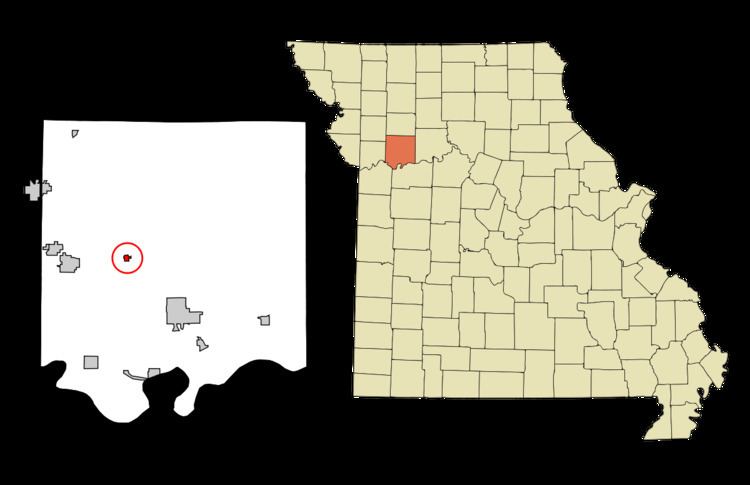
Map of Rayville, MO 64084, USA
History
Rayville was platted in 1871. The community takes its name from Ray County. A post office called Rayville has been in operation since 1870.
Geography
Rayville is located at 39°20′56″N 94°3′50″W (39.348822, -94.063847).
According to the United States Census Bureau, the village has a total area of 0.25 square miles (0.65 km2), all of it land.
2010 census
As of the census of 2010, there were 223 people, 68 households, and 54 families residing in the village. The population density was 892.0 inhabitants per square mile (344.4/km2). There were 75 housing units at an average density of 300.0 per square mile (115.8/km2). The racial makeup of the village was 97.3% White, 0.4% African American, and 2.2% from two or more races. Hispanic or Latino of any race were 1.3% of the population.
There were 68 households of which 45.6% had children under the age of 18 living with them, 51.5% were married couples living together, 16.2% had a female householder with no husband present, 11.8% had a male householder with no wife present, and 20.6% were non-families. 19.1% of all households were made up of individuals and 5.8% had someone living alone who was 65 years of age or older. The average household size was 3.28 and the average family size was 3.74.
The median age in the village was 30.5 years. 33.2% of residents were under the age of 18; 9.8% were between the ages of 18 and 24; 23.7% were from 25 to 44; 21.5% were from 45 to 64; and 11.7% were 65 years of age or older. The gender makeup of the village was 54.3% male and 45.7% female.
2000 census
As of the census of 2000, there were 204 people, 72 households, and 55 families residing in the village. The population density was 836.7 people per square mile (328.2/km²). There were 82 housing units at an average density of 336.3 per square mile (131.9/km²). The racial makeup of the village was 97.55% White, and 2.45% from two or more races.
There were 72 households out of which 31.9% had children under the age of 18 living with them, 52.8% were married couples living together, 15.3% had a female householder with no husband present, and 23.6% were non-families. 15.3% of all households were made up of individuals and 9.7% had someone living alone who was 65 years of age or older. The average household size was 2.83 and the average family size was 3.15.
In the village, the population was spread out with 23.5% under the age of 18, 14.2% from 18 to 24, 25.5% from 25 to 44, 23.5% from 45 to 64, and 13.2% who were 65 years of age or older. The median age was 37 years. For every 100 females there were 94.3 males. For every 100 females age 18 and over, there were 113.7 males.
The median income for a household in the village was $32,750, and the median income for a family was $35,000. Males had a median income of $31,250 versus $18,125 for females. The per capita income for the village was $12,769. About 15.5% of families and 15.6% of the population were below the poverty line, including 10.9% of those under the age of eighteen and 3.2% of those sixty five or over.