
Time zone WET (UTC+0) Area 194.5 km² | Irish Grid Reference N262506 | |
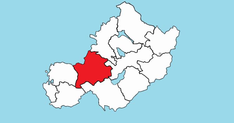 | ||
Rathconrath (Irish: Ráth Conarta), previously the barony of Rathcomyrta, before that Daltons country, is a barony in the west of County Westmeath, in the Republic of Ireland. It was formed by 1542. It is bordered by County Longford to the north–west and five other Westmeath baronies: Moygoish to the north, Moyashel and Magheradernon to the east, Moycashel and Clonlonan to the south and Kilkenny West to the west. Note that the village of Rathconrath is not synonymous with the barony of the same name.
Contents
Geography
Rathconrath has an area of 48,068 acres (194.52 km2). Uisneach hill rises to 182 metres (597 ft).
Civil parishes of the barony
This table lists an historical geographical sub-division of the barony known as the civil parish (not to be confused with an Ecclesiastical parish).
Towns, villages and townlands
There are 162 townlands in the barony of Rathconrath.