Arabic رأس أبو عمار Palestine grid 158/127 | Date of depopulation 21 October 1948 | |
 | ||
Name meaning The hill top of Abu Ammar Cause(s) of depopulation Military assault by Yishuv forces | ||
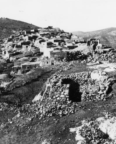
Ras Abu 'Ammar (Arabic: رأس أبو عمار) was a Palestinian Arab village in the Jerusalem Subdistrict. It was depopulated during the 1948 Arab-Israeli War on October 21, 1948 by the Har'el Brigade of Operation ha-Har. It was located 14 km west of Jerusalem, surrounded on three sides by the Wadi al-Sarar.
Contents
History
The nearby Kh. Kafr Sum have remains from the Crusader era, including a court-yard building and rock-cut cisterns. A tower to the south east was later turned into Maqam ash-sheikh Musafar. Victor Guérin noted that: "There are a lot of rickety houses, which are built of small, almost unhewn stones, near one waly, which stands in the shade of a mulberry tree of several hundreds years old. Not far from it there is a semicircle swimming pool, built in a crude way". And further: "A large structure, partly built of ancient stones with typical projection, served as a mosque, as we can tell from the presence of the mihrab in it. It is very likely that the structure had stood before the Muslims settled here, and they just adopted it for their cult"
The SWP described it as "a small stone village on a hill; to the east in a small valley is a good spring, with a rock-cut tomb beside it."
Ottoman era
Victor Guérin visited in 1863.
An Ottoman village list from around 1870 showed that Ras Abu Ammar had 6 (?) houses and a population of 92, though the population count included men, only.
In 1883, the Palestine Exploration Fund's Survey of Western Palestine (SWP) described Ras (Abu 'Ammar) as "a large stone village on a spur, with a fine spring in the valley to the north-west. The hill has only a little scrub on it, but the valley, which is open and rather flat, has olives in it."
British Mandate era
In the 1922 census of Palestine conducted by the British Mandate authorities, Ras Abu Ammar had a population 339, all Muslims, increasing in the 1931 census to 488, in 106 houses.
In 1945, the village, with a population of 620 Muslims, had 8,342 dunams of land according to an official land and population survey. Of the land, 925 dunams were plantations and irrigable land 2,791 were for cereals, while 40 dunams were built-up (urban) land.
