
Country United States FIPS code 37-55260 Elevation 243 m Zip code 28054 Local time Friday 1:13 PM | Time zone Eastern (EST) (UTC-5) GNIS feature ID 0993035 Area 4.4 km² Population 3,485 (2013) Area code 704 | |
 | ||
Weather 18°C, Wind SW at 11 km/h, 45% Humidity | ||
Ranlo is a small town in Gaston County, North Carolina, United States and a suburb of both Charlotte and Gastonia. As of the 2010 census, the town population was 3,434, up from 2,198 in 2000.
Contents
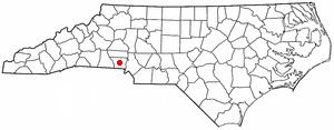
Map of Ranlo, NC, USA
Geography
Ranlo is located at 35°17′25″N 81°8′1″W (35.290393, -81.133731).
According to the United States Census Bureau, the town has a total area of 1.7 square miles (4.4 km2), all of it land.
History
Ranlo was named for John Calvin Rankin and William Thomas Love, two prominent area industrialists - "Ranlo" was a contraction of RANkin and LOve. The community grew up around their textile mills, which produced cotton goods. Rex Spinning Company was begun in 1915, Ranlo Manufacturing Company in 1916, and Priscilla Spinning Company in 1921. Nearby, the community of Smyre was developed around the A. M. Smyre Manufacturing Company, which was founded in 1917. In 1963, Ranlo and Smyre were incorporated as the Town of Ranlo, in reaction to the concern over possible annexation into Gastonia. However, the part of the Smyre mill village south of the Norfolk Southern Railway was not included, and was eventually annexed by Gastonia in June 1996.
Row houses were erected in the 1920s and 1930s and still stand today. At the time, they were owned by the mill and rented at very low rates to workers. They have long since been sold to individuals, and the mills are 75-80% closed. Only one or two still operate and they are at low capacity. The town, however, has become a "bedroom community" and prides itself on its facilities and growth. New industry has started to move in and new neighborhoods are being built.
Demographics
As of the census of 2000, there were 2,198 people, 857 households, and 642 families residing in the town. The population density was 1,598.5 people per square mile (619.5/km²). There were 917 housing units at an average density of 666.9 per square mile (258.4/km²). The racial makeup of the town was 91.86% White, 6.10% African American, 0.32% Native American, 0.36% Asian, 0.27% Pacific Islander, 0.14% from other races, and 0.96% from two or more races. Hispanic or Latino of any race were 0.55% of the population.
There were 857 households out of which 26.5% had children under the age of 18 living with them, 56.2% were married couples living together, 14.4% had a female householder with no husband present, and 25.0% were non-families. 21.2% of all households were made up of individuals and 9.1% had someone living alone who was 65 years of age or older. The average household size was 2.56 and the average family size was 2.95.
In the town, the population was spread out with 23.0% under the age of 18, 7.7% from 18 to 24, 28.4% from 25 to 44, 26.3% from 45 to 64, and 14.6% who were 65 years of age or older. The median age was 38 years. For every 100 females, there were 95.0 males. For every 100 females age 18 and over, there were 89.8 males.
The median income for a household in the town was $35,160, and the median income for a family was $40,391. Males had a median income of $31,534 versus $21,250 for females. The per capita income for the town was $17,180. About 6.7% of families and 8.1% of the population were below the poverty line, including 12.3% of those under age 18 and 7.8% of those age 65 or over.