
FIPS code 19-65550 Elevation 340 m Zip code 52164 Population 67 (2013) | Time zone Central (CST) (UTC-6) GNIS feature ID 0460519 Area 57 ha Local time Friday 7:20 AM Area code 563 | |
 | ||
Weather 4°C, Wind SE at 11 km/h, 100% Humidity | ||
Randalia is a city in Fayette County, Iowa, United States. The population was 68 at the 2010 census.
Contents
Map of Randalia, IA 52164, USA
Geography
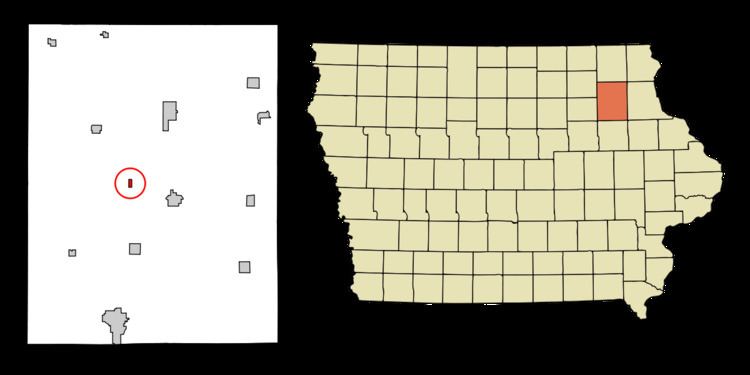
Randalia is located at 42°51′44″N 91°53′13″W (42.862196, -91.886814).
According to the United States Census Bureau, the city has a total area of 0.22 square miles (0.57 km2), all of it land.
2010 census
As of the census of 2010, there were 68 people, 29 households, and 21 families residing in the city. The population density was 309.1 inhabitants per square mile (119.3/km2). There were 37 housing units at an average density of 168.2 per square mile (64.9/km2). The racial makeup of the city was 94.1% White and 5.9% from two or more races.
There were 29 households of which 27.6% had children under the age of 18 living with them, 65.5% were married couples living together, 6.9% had a male householder with no wife present, and 27.6% were non-families. 27.6% of all households were made up of individuals and 3.4% had someone living alone who was 65 years of age or older. The average household size was 2.34 and the average family size was 2.76.
The median age in the city was 41.5 years. 17.6% of residents were under the age of 18; 11.9% were between the ages of 18 and 24; 22.1% were from 25 to 44; 30.9% were from 45 to 64; and 17.6% were 65 years of age or older. The gender makeup of the city was 55.9% male and 44.1% female.
2000 census
As of the census of 2000, there were 84 people, 32 households, and 22 families residing in the city. The population density was 387.3 people per square mile (147.4/km²). There were 36 housing units at an average density of 166.0 per square mile (63.2/km²). The racial makeup of the city was 100.00% White.
There were 32 households out of which 31.3% had children under the age of 18 living with them, 53.1% were married couples living together, 12.5% had a female householder with no husband present, and 31.3% were non-families. 21.9% of all households were made up of individuals and 6.3% had someone living alone who was 65 years of age or older. The average household size was 2.63 and the average family size was 3.18.
In the city, the population was spread out with 26.2% under the age of 18, 10.7% from 18 to 24, 26.2% from 25 to 44, 19.0% from 45 to 64, and 17.9% who were 65 years of age or older. The median age was 36 years. For every 100 females there were 78.7 males. For every 100 females age 18 and over, there were 87.9 males.
The median income for a household in the city was $36,875, and the median income for a family was $40,625. Males had a median income of $25,625 versus $23,571 for females. The per capita income for the city was $12,018. There were 24.0% of families and 23.6% of the population living below the poverty line, including 34.6% of under eighteens and 41.7% of those over 64.
Decline
Locals in Randalia have been finding their community in a state of decline. In October 2007, the city lost its post office, some time after losing its school and general store.