
 | ||
Rame head victoria top 7 facts
Rame Head or Ram Head (37°46′S 149°29′E) is a coastal headland in eastern Victoria, Australia. It is within the Croajingolong National Park.
The local aboriginal people call the headland Konowee or Kouowee. James Cook (Captain Cook) named today's Rame Head as he passed by on 20 April 1770. Cook named the point Ram Head, after a point that can be seen going into Plymouth Sound, Cook wrote the name without an "e" and that spelling was adopted by Aaron Arrowsmith, George Bass, Matthew Flinders, James Grant, Louis de Freycinet and even John Hawesworth when commissioned by the Admiralty to edit Cook's papers and journal and that spelling became official when the Admiralty published Matthew Flinders' charts dated January and February 1814. The Royal Navy (and later Royal Australian Navy) used the old spelling "Rame" in the mid 1800s; while Ram Head still continues to be used also. In 1971, the Victorian Government gazetted the point as "Rame" to match its Cornish namesake.
Locals pronounce the name like "Sam", whereas the headland in Cornwall is now pronounced like "same". The former reflects the initial spelling, when Bay was spelt "Baye". In Cook's time, Naval Charts used Cook's spelling for the point in Cornwall, and the small village nearby mainly used the new spelling, around 1810 the point in Cornwall once again reverted to Rame. There are many grave stones in the area, dating to the mid 1700s that also used "Ram".
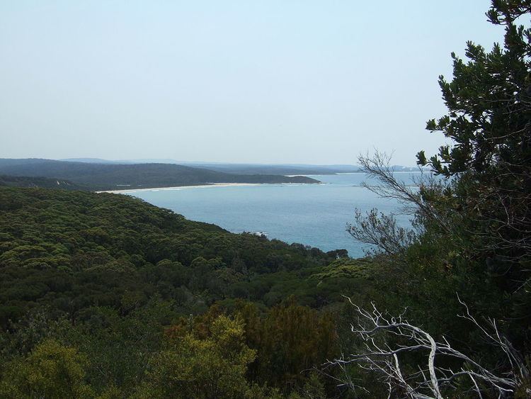
There is a walking track to the "summit" of the head. However, this point lacks a clear vantage point over surrounding scrub, and is simply marked by a trig point.