Harman Patil (Editor)

Radibor

Updated on
Edit
Like
Comment
Share on FacebookTweet on TwitterShare on LinkedInShare on Reddit
Country
  
District
  
Time zone
  
CET/CEST (UTC+1/+2)

Area
  
61.93 km²

Local time
  
Wednesday 11:58 PM

Dialling code
  
035935

State
  
Elevation
  
165 m (541 ft)

Postal codes
  
02627

Population
  
3,471 (31 Dec 2008)

Postal code
  
02627

Radibor httpsuploadwikimediaorgwikipediacommonsthu

Weather
  
6°C, Wind E at 14 km/h, 74% Humidity

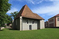
Radibor, in Sorbian Radwor, is a municipality in Saxony in Germany. It is situated in Upper Lusatia about 10 km north of Bautzen, which is also the main city of the District of Bautzen to which Radibor belongs.

Map of Radibor, Germany

Radibor was first mentioned in a written source in 1359. Its name is of Sorbian origin and generally means "place of the council". The municipality belongs to the central settlement area of the Sorbs.

Following villages belong to the municipality of Radibor:

  • Bornitz (Boranecy), 125 inh.
  • Brohna (Bronjo), 73 inh.
  • Camina (Kamjenej), 119 inh.
  • Cölln (Chelno), 356 inh.
  • Droben (Droby), 89 inh.
  • Großbrösern (Wulki Přezdrěń), 46 inh.
  • Lippitsch (Lipič), 193 inh.
  • Lomske (Łomsk), 205 inh.
  • Luppa (Łupoj), 205 inh.
  • Luppedubrau (Łupjanska Dubrawka), 79 inh.
  • Luttowitz (Lutobč), 162 inh.
  • Merka (Měrkow), 139 inh.
  • Milkel (Minakał), 420 inh.
  • Milkwitz (Miłkecy), 113 inh.
  • Neu-Bornitz (Nowe Boranecy), 61 inh.
  • Neu-Brohna (Nowe Bronjo), 20 inh.
  • Quoos (Chasow), 156 inh.
  • Radibor (Radwor), 704 inh.
  • Schwarzadler (Čorny Hodler), 37 inh.
  • Teicha (Hat), 75 inh.
  • Wessel (Wjesel), 99 inh.
  • References

    Radibor Wikipedia


    Similar Topics