
Area 26.91 km² | Postal code 391 20 to 391 55 Elevation 503 m Population 478 (2006) | |
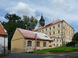 | ||
Radenín is a village and municipality (obec) in Tábor District in the South Bohemian Region of the Czech Republic.
Map of Raden%C3%ADn, Czechia
The municipality covers an area of 26.91 square kilometres (10.39 sq mi), and has a population of 478 (as at 28 August 2006).
Radenín lies approximately 14 kilometres (9 mi) east of Tábor, 51 km (32 mi) north-east of České Budějovice, and 86 km (53 mi) south of Prague.
References
Radenín Wikipedia(Text) CC BY-SA