Trisha Shetty (Editor)

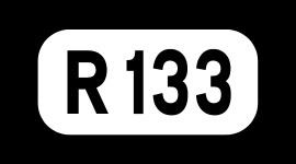
R133 road (Ireland)

Updated on
Edit
Like
Comment
Share on FacebookTweet on TwitterShare on LinkedInShare on Reddit
Length
  
3.9 km

Province
  
Leinster

R133 road (Ireland)

Primarydestinations:
  
Dún Laoghaire–RathdownGoatstown (R112, R825)Drummartin (R825)Sandyford (M50 J13E, R113)Ballinteer (M50 J13W, R113, R826)

The R133 road is a regional road in south Dublin, Ireland. The road starts at Goatstown and runs in a southerly direction towards Sandyford before acting as a link road for the M50.

Contents

Map of R133, Dublin, Ireland

Route

  • The road starts at the crossroads in Goatstown where it joins with the R112 and R825 and heads south. The road is known as the Lower Kilmacud Road before a minor junction where it becomes known as Drumartin Road.
  • At the next junction it joins with the R825 again and runs south into the recently built Drummartin Link Road. A short distance later is another signaled junction when it crosses the Upper Kilmacud Road.
  • It then crosses the Luas Green line passing beside the Kilmacud station and the newly built Sandyford Drummartin Link Road.
  • After this the road continues south to another major junction at the Sandyford Industrial Estate, intersecting with Blackthorn Drive. The road then goes from single to dual lanes as a link road to the M50. At the M50 Junction 13 (East) there is a roundabout currently being upgraded as part of the M50 works.
  • The route continues as a link road to Junction 13 (West) of the M50 (Ballinteer and Dundrum) running in a westerly direction parallel to the motorway that joins with the R826 and R113. This section of the route is a two lane carriageway running in a one way direction from Dundrum to Sandyford.
  • References

    R133 road (Ireland) Wikipedia