
Postcode district TR9 Local time Tuesday 7:42 PM Civil parish St Columb Major | Post town ST. COLUMB Dialling code 01637 | |
 | ||
Weather 6°C, Wind S at 27 km/h, 87% Humidity | ||
Quoit is a settlement in mid Cornwall, England, United Kingdom. It is situated in the parish of St. Columb Major approximately one mile (2 km) southeast of the town of St Columb Major and 7 miles (12 km) east of Newquay. It lies between the A30 dual carriageway trunk road and the A39 road through St Columb Major.
Contents
Map of Quoit, Saint Columb, UK
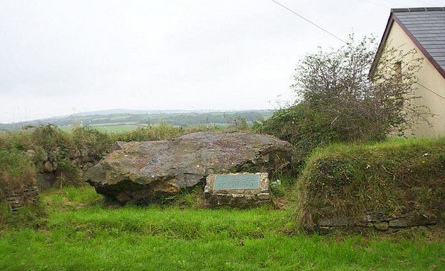
Devil's Quoit
The hamlet derives its name from a dolmen known as "Devil's Quoit" (or "Arthur's Quoit") at grid reference SW92326193. Although one support stone was removed in the 18th century, the dolmen was still standing in 1840. It partially collapsed between 1840 and 1850. By the 20th century, the stones had been split and either deliberately buried or incorporated in surrounding hedges.
References
Quoit, Cornwall Wikipedia(Text) CC BY-SA