
Airport type Public Elevation AMSL 42 ft / 13 m 4,000 1,219 Elevation 13 m | Serves Quinhagak, Alaska 12/30 4,000 Code KWN Phone +1 907-556-8165 | |
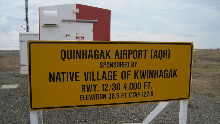 | ||
Owner Native Village of Kwinhagak Address Togiak National Wildlife Refuge, Quinhagak, AK 99655, USA | ||
Quinhagak Airport (IATA: KWN, ICAO: PAQH, FAA LID: AQH), is a public-use airport located two nautical miles (3.7 km) east of the central business district of Quinhagak (also spelled Kwinhagak), a city in the Bethel Census Area of the U.S. state of Alaska. It is also known as Kwinhagak Airport.
Although most U.S. airports use the same three-letter location identifier for the FAA and IATA, this airport is assigned AQH by the FAA and KWN by the IATA. The airport's ICAO identifier is PAQH.
Facilities and aircraft
Quinhagak Airport covers an area of 123 acres (50 ha) at an elevation of 42 feet (13 m) above mean sea level. It has one runway designated 12/30 with a gravel surface measuring 4,000 by 75 feet (1,219 x 23 m). The runway was expanded from its former size of 2,600 by 60 feet (792 m × 18 m).