
Country United States County Osage FIPS code 20-58100 Elevation 288 m Zip code 66528 Population 382 (2013) | Time zone Central (CST) (UTC-6) GNIS feature ID 0479622 Area 114 ha Local time Tuesday 6:35 AM Area code 785 | |
 | ||
Weather 11°C, Wind NE at 19 km/h, 62% Humidity | ||
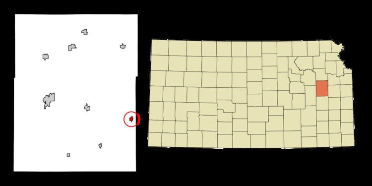
Quenemo is a city in Osage County, Kansas, United States, along the Marais des Cygnes River. As of the 2010 census, the city population was 388.
Contents
- Map of Quenemo KS 66528 USA
- History
- Geography
- Climate
- Demographics
- 2010 census
- 2000 census
- Education
- Parks and Recreation
- References
Map of Quenemo, KS 66528, USA
History
Quenemo was laid out about 1870. Quenemo was the name of a Sac and Fox Indian chief. A fire in 1878 destroyed much of the town. Quenemo experienced rapid growth in 1884 after the railroad was built through it.
Geography
Quenemo is located at 38°34′49″N 95°31′40″W (38.580413, -95.527895). According to the United States Census Bureau, the city has a total area of 0.44 square miles (1.14 km2), all of it land.
Climate
The climate in this area is characterized by hot, humid summers and generally mild to cool winters. According to the Köppen Climate Classification system, Quenemo has a humid subtropical climate, abbreviated "Cfa" on climate maps.
Demographics
Quenemo is part of the Topeka, Kansas Metropolitan Statistical Area.
2010 census
As of the census of 2010, there were 388 people, 139 households, and 90 families residing in the city. The population density was 881.8 inhabitants per square mile (340.5/km2). There were 178 housing units at an average density of 404.5 per square mile (156.2/km2). The racial makeup of the city was 93.3% White, 1.3% African American, 2.6% Native American, 0.3% from other races, and 2.6% from two or more races. Hispanic or Latino of any race were 1.8% of the population.
There were 139 households of which 39.6% had children under the age of 18 living with them, 44.6% were married couples living together, 9.4% had a female householder with no husband present, 10.8% had a male householder with no wife present, and 35.3% were non-families. 25.9% of all households were made up of individuals and 7.2% had someone living alone who was 65 years of age or older. The average household size was 2.79 and the average family size was 3.44.
The median age in the city was 32.3 years. 31.7% of residents were under the age of 18; 9.3% were between the ages of 18 and 24; 23.2% were from 25 to 44; 28.4% were from 45 to 64; and 7.5% were 65 years of age or older. The gender makeup of the city was 54.1% male and 45.9% female.
2000 census
As of the census of 2000, there were 468 people, 169 households, and 128 families residing in the city. The population density was 1,121.9 people per square mile (430.2/km²). There were 192 housing units at an average density of 460.3 per square mile (176.5/km²). The racial makeup of the city was 93.16% White, 0.21% African American, 2.99% Native American, and 3.63% from two or more races. Hispanic or Latino of any race were 0.43% of the population.
There were 169 households out of which 42.0% had children under the age of 18 living with them, 56.8% were married couples living together, 16.0% had a female householder with no husband present, and 23.7% were non-families. 21.3% of all households were made up of individuals and 5.3% had someone living alone who was 65 years of age or older. The average household size was 2.77 and the average family size was 3.16.
In the city, the population was spread out with 34.0% under the age of 18, 7.1% from 18 to 24, 29.7% from 25 to 44, 20.7% from 45 to 64, and 8.5% who were 65 years of age or older. The median age was 31 years. For every 100 females there were 100.9 males. For every 100 females age 18 and over, there were 103.3 males.
The median income for a household in the city was $25,000, and the median income for a family was $28,854. Males had a median income of $27,019 versus $14,375 for females. The per capita income for the city was $9,943. About 19.4% of families and 24.0% of the population were below the poverty line, including 30.1% of those under the age of 18 and none of those aged 65 or over.
Education
Quenemo is a part of USD 456 Marais des Cygnes Valley. The district high school is Marais des Cygnes Valley High School. Mascot is Trojans.
Prior to school unification, Quenemo High School won the Kansas State High School boys class BB basketball championship in 1960.