
Area code(s) 718, 347, 917, 929 Hispanic population 18.4% White population 6.3% | State New York ZIP code 11427, 11428, 11429 Asian population 16% Black population 50.2% Population 52,504 (2010) | |
 | ||
Restaurants Caribbean Delights, Labadee Manoir Inc, Rice & Beans Restaurant, Hops Kitchen, Mateus' Restaurant & Bar | ||
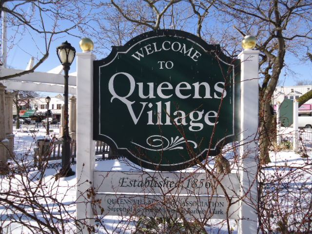
Queens Village is a mostly residential middle class neighborhood in the eastern part of the New York City borough of Queens. The Queens Village Post Office serves the ZIP codes of 11427 (Hollis Hills), 11428 (central Queens Village), and 11429 (Bellaire). The neighborhood is part of Queens Community Board 13.
Contents
- Map of Queens Village Queens NY USA
- History
- Other Queens Village on Long Island
- Bellaire
- Hollis Hills
- Demographics
- Transportation
- Education
- Notable residents
- References
Map of Queens Village, Queens, NY, USA
Shopping in the community is located along Braddock Avenue, Hillside Avenue, Hempstead Avenue, and Jamaica Avenue (NY 25), as well as on Springfield Boulevard. Located just east of Queens Village, in Nassau County, is the Belmont Park race track.
Within the neighborhood are Cunningham Park and Alley Pond Park, as well as the historic Long Island Motor Parkway (LIMP), home of the turn of the century racing competition, the Vanderbilt Cup. The LIMP was built by William Kissam Vanderbilt, a descendant of the family that presided over the New York Central Railroad and Western Union; it is now part of the Brooklyn-Queens Greenway used by bicyclists, joggers and nature trail lovers.
History
Queens Village was founded as Little Plains in the 1640s. Homage to this part of Queens Village history is found on the sign above the Long Island Railroad Station there. In 1824, Thomas Brush established a blacksmith shop in the area. He prospered and built several other shops and a factory, and the area soon became known as Brushville. On March 1, 1837, the railroad arrived. The first station in the area was called Flushing Avenue in 1837, Delancy Avenue by June 20, 1837, and Brushville by November 27, 1837, likely about a mile west of the present station. In 1856, residents voted to change the name from Brushville to Queens. The name "Inglewood" also was used for both the village and the train station in the 1860s and 1870s. The name Brushville was still used in an 1860 New York Times article, but both "Queens" and "Brushville" are used in an 1870 article. Maps from 1873 show portions of Queens Village (then called Inglewood and Queens) in the town of Hempstead, but 1891 maps show it entirely in the town of Jamaica.
After the Borough of Queens became incorporated as part of the City of Greater New York in 1898, and the new county of Nassau was created in 1899, the border between the city and Nassau County was set directly east of Queens Village. A 1901 article in the Brooklyn Eagle already uses the full name Queens Village, a name that had been used as late as the 1880s for Lloyd's Neck in present-day Suffolk County. In 1923, the Long Island Railroad added "Village" to its station’s name to avoid confusion with the county of the same name, and thus the neighborhood became known as Queens Village.
Queens Village was part of an overall housing boom that was spreading east through Queens from New York as people from the city sought the bucolic life afforded by the less-crowded atmosphere of the area. Today, many of those charming and well-maintained Dutch Colonial and Tudor homes built in Queens Village during the 1920s and 1930s currently continue to attract an interestingly diverse population.
Other Queens Village on Long Island
Lloyd Harbor, New York, which was formerly in Queens County but now in Suffolk County but then in Queens County, was known as Queens Village from 1685 until as late as 1883. In 1885, known then as Lloyd Neck, it seceded from Queens County and became part of the town of Huntington in Suffolk County.
Bellaire
Bellaire is in western Queens Village next to Hollis and covers the area surrounding Jamaica Avenue and 211th Street. Bellaire is the largest section of Queens Village. The area considered Bellaire usually falls under the general title of Queens Village. There was once a Long Island Rail Road station named Bellaire. 211th Street, formerly known as Belleaire Boulevard has traffic medians on it indicating its history as the main route through this section of Queens Village.
Hollis Hills
Hollis Hills is an affluent subsection, generally bounded by Springfield Boulevard to the east, Grand Central Parkway the south, Hollis Hills Terrace to the west, and Kingsbury Avenue and Richland Avenue the north. It is slightly above sea level due to a retreating glacier from the last Ice Age.
Most homes in Hollis Hills are of the Colonial, Tudor, and Ranch styles. Houses here attract predominantly the upper-middle class as some houses in the area can fetch prices of $1,500,000 or higher. This neighborhood, similar to Douglaston, is a quasi-suburb, with detached homes sitting on large tree-lined lots. Surrey Estates, a section of Hollis Hills, is a smaller triangle of architecturally notable homes surrounded by old, large trees and is bound by Union Turnpike, Springfield Boulevard, and Hartland Avenue within Hollis Hills.
Notable institutions in Hollis Hills are The Chapel of the Redeemer Lutheran, Hollis Hills Jewish Center (founded in 1948), American Martyrs Catholic Church, the Windsor Park Branch of the Queens Borough Public Library, the John Hamburg Community Center, Kingsbury Elementary School (P.S. 188), Hollis Hills Civic Association, and Surrey Estates Homeowners Association.
Demographics
Queens Village, like many parts of Queens, is diverse. The neighborhood is mainly Caribbean American and African American, but Asian, African American, Guyanese, Hispanic, Indian, Filipino, and Russian people also have significant populations among the 48,670 people living within the area. Formerly, a very large Jewish community existed. However, many Jewish families have left for other parts of Queens and parts of Long Island. Still, there is a small Jewish presence in Queens Village that has recently been augmented by an increase of Middle Eastern Jews. There has also been an increase in the number of Asian American residents.
Based on data from the 2010 United States Census, the population of Queens Village was 52,504, a decrease of 5,200 (9.0%) from the 57,704 counted in 2000. Covering an area of 1,611.17 acres (652.02 ha), the neighborhood had a population density of 32.6 inhabitants per acre (20,900/sq mi; 8,100/km2).
The racial makeup of the neighborhood was 6.3% (3,304) White, 50.2% (26,376) African American, 0.5% (279) Native American, 16.0% (8,424) Asian, 0.1% (64) Pacific Islander, 3.9% (2,066) from other races, and 4.4% (2,320) from two or more races. Hispanic or Latino of any race were 18.4% (9,671) of the population.
Queens Village is one of Queens's affluent neighborhoods. As of 2008, the median income is $66,290, and the median home sales price is around $467,764.
Transportation
Queens Village station, located at Springfield Boulevard and Amboy Lane, offers service on the Long Island Rail Road Hempstead Branch.
New York City Bus serves Queens Village on the Q1, Q2, Q27, Q36, Q43, Q46, Q76, Q77, Q83, Q88, Q110, X68 routes, and Nassau Inter-County Express serves the area on the n1, n6, n22, n22L, n22A, n24, n26 routes.
Education
Schools in Queens Village include the following: