
Basin countries United Kingdom Average depth 15.3 m (50 ft) Area 128 ha | Surface area 127.9 ha (316 acres) Max. depth 17.8 m (58 ft) Mean depth 15 m | |
 | ||
Similar Island Barn Reservoir, St George's Church - Esher, Church of St Nicholas, Sunbury Lock, Hinchley Wood railway st | ||
The Queen Elizabeth II Reservoir lies to the south of the River Thames and to the west of the Island Barn Reservoir. To the north are the reservoirs of Bessborough and Knight. The A3050 runs to the north of the reservoir and it is situated in Walton on Thames. It is managed by Thames Water.
Map of Queen Elizabeth II Storage Reservoir, Walton-on-Thames, UK
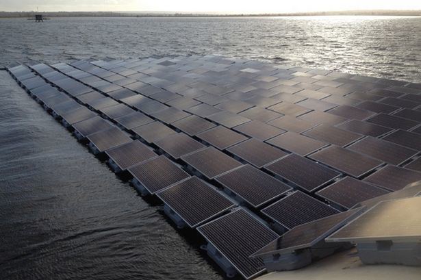
The reservoir was authorised by an Act of Parliament in 1935, but construction was halted on the outbreak of World War II. Work did not begin again until 1957 and, after the works were completed by W. & C. French, it was commissioned in 1962. The reservoir covers 317 acres (1.28 km2), has a mean depth of 15.3 m, a maximum depth of 17.8 m and holds 4,300 million gallons (20,000 million litres).
Bewick's swans have been spotted on this reservoir.
References
Queen Elizabeth II Reservoir Wikipedia(Text) CC BY-SA