
County Ottawa Area code(s) 539/918 Elevation 258 m Zip code 74363 Local time Monday 8:11 PM | Time zone Central (CST) (UTC-6) FIPS code 40-61400 Area 155 ha Population 909 (2013) | |
 | ||
Weather 26°C, Wind SE at 3 km/h, 52% Humidity | ||
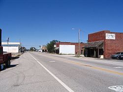
Quapaw is a town in Ottawa County, Oklahoma, United States. The population was 906 at the 2010 census, a 7.9 percent decline from 984 as of the 2000 census. Quapaw is part of the Joplin, Missouri metropolitan area.
Contents
Map of Quapaw, OK 74363, USA
History
In 1891 Kansas farmer Isaac Bingham moved his family south into Ottawa County. The family established a community and opened several businesses. Quapaw Chief John Quapaw donated land for a community school. The Kansas City, Fort Scott and Memphis Railroad established a railroad stop and siding at the community location. This established access to markets for hay and agricultural products of the area. A post office was opened in the community grocery store in 1897.
The community leaders platted "New Town Quapaw," on land to the east purchased from native Harry Whitebird. This "new" town was incorporated in 1917 as Quapaw. Discovery of lead and zinc ores in the area resulted in this area being part of the Tri-State mining district, and resulted in a population boom as thousands of miners moved into the larger area. Native Americans were generally excluded from mining, although the county had a significant proportion from several federally recognized tribes. With the population and economic boom, new businesses were developed. The 1920 census listed 1,394 residents. In the 1920s U. S. Route 66 was developed through Quapaw and was paved through Ottawa County by 1933. This event was celebrated with Quapaw Chief Victor Griffin laying a zinc tablet in the center of Main Street.
Quapaw began to lose residents as the local mining operations began to decline. The population declined to 1,054 by 1940 and as mining activity in the area declined, the population dropped to 850 in 1960.
Geography
According to the United States Census Bureau, the town has a total area of 0.6 square miles (1.6 km2), all land. Quapaw is 9 miles (14 km) north of Miami, Oklahoma and is the last town in Oklahoma on U.S. Highway 69A before the Kansas state line.
Demographics
As of the census of 2000, there were 984 people, 352 households, and 258 families residing in the town. The population density was 1,759.4 people per square mile (678.4/km²). There were 423 housing units at an average density of 756.3 per square mile (291.6/km²). The racial makeup of the town was 68.60% White, 22.46% Native American, 0.20% Asian, 0.10% from other races, and 8.64% from two or more races. Hispanic or Latino of any race were 1.52% of the population.
There were 352 households out of which 31.5% had children under the age of 18 living with them, 52.8% were married couples living together, 14.2% had a female householder with no husband present, and 26.7% were non-families. 22.4% of all households were made up of individuals and 11.6% had someone living alone who was 65 years of age or older. The average household size was 2.72 and the average family size was 3.16.
In the town, the population was spread out with 28.7% under the age of 18, 9.7% from 18 to 24, 22.8% from 25 to 44, 22.9% from 45 to 64, and 16.1% who were 65 years of age or older. The median age was 35 years. For every 100 females there were 97.2 males. For every 100 females age 18 and over, there were 87.2 males.
The median income for a household in the town was $24,083, and the median income for a family was $29,375. Males had a median income of $25,625 versus $17,279 for females. The per capita income for the town was $10,182. About 22.3% of families and 28.3% of the population were below the poverty line, including 41.1% of those under age 18 and 18.1% of those age 65 or over.
In pop culture
Quapaw was mentioned in a 1976 episode of the television show, M*A*S*M*A*S*H, a U.S. situation comedy. In the episode "The Colonel's Horse," when Colonel Potter goes to Tokyo on R&R, his horse develops colic. Mike Farrell's character B.J. said his wife Peg (played by Catherine Bergstrom) was from Quapaw and that his father-in-law knew all about horses; they called him for advice. Ironically, fellow M*A*S*M*A*S*H cast member Judy Farrell, Mike Farrell's real-life wife at the time, was born in Quapaw.
Quapaw is mentioned in the film Oklahoma, as one of the towns in which the character Jud had worked at some point in the past. Jud recounted a fictional case of deadly arson that occurred five years prior to the film's setting.