
Country United States County Livingston FIPS code 26-66540 Elevation 277 m Population 7,500 (2000) | Time zone Eastern (EST) (UTC-5) GNIS feature ID 1626946 Local time Thursday 12:36 PM | |
 | ||
Weather 3°C, Wind E at 26 km/h, 93% Humidity Area 91.94 km² (89.1 km² Land / 3.108 km² Water) | ||
Putnam Township is a civil township of Livingston County in the U.S. state of Michigan. The population was 7,500 at the 2000 census.
Contents
Map of Putnam Township, MI, USA
Communities
Geography
According to the United States Census Bureau, the township has a total area of 35.5 square miles (92 km2), of which, 34.4 square miles (89 km2) of it is land and 1.2 square miles (3.1 km2) of it (3.32%) is water.
Government
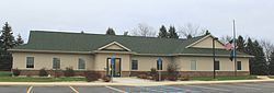
The government of Putnam township is a civil township with trustees Richard McCloskey, Keith Chambers, Kevin Dobis, Norm Klein, supervisor Ronald Rau, treasurer Pat Carney, treasurer/deputy Tracy Taylor, zoning administrator Thomas Lewis, assessor Amy Pashby, clerk Sally D. Guyon, clerk/deputy Carrie Humble and fire chief Greg Amburgey.
Demographics
As of the census of 2000, there were 7,500 people, 2,626 households, and 2,087 families residing in the township. The population density was 218.3 per square mile (84.3/km²). There were 2,894 housing units at an average density of 84.2 per square mile (32.5/km²). The racial makeup of the township was 97.81% White, 0.17% African American, 0.33% Native American, 0.24% Asian, 0.05% Pacific Islander, 0.20% from other races, and 1.19% from two or more races. Hispanic or Latino of any race were 0.91% of the population.
There were 2,626 households out of which 39.7% had children under the age of 18 living with them, 68.1% were married couples living together, 7.6% had a female householder with no husband present, and 20.5% were non-families. 15.4% of all households were made up of individuals and 4.5% had someone living alone who was 65 years of age or older. The average household size was 2.84 and the average family size was 3.18.
In the township the population was spread out with 27.7% under the age of 18, 7.6% from 18 to 24, 32.9% from 25 to 44, 24.6% from 45 to 64, and 7.1% who were 65 years of age or older. The median age was 36 years. For every 100 females there were 104.2 males. For every 100 females age 18 and over, there were 102.3 males.
The median income for a household in the township was $61,388, and the median income for a family was $63,704. Males had a median income of $49,211 versus $31,017 for females. The per capita income for the township was $23,974. About 2.8% of families and 3.9% of the population were below the poverty line, including 3.2% of those under age 18 and 5.1% of those age 65 or over.