
- right Zăbala, Milcov, Râmna - location Vulturu Basin area 2,720 km² Mouth Siret | - location Vrancea Mountains Length 144 km Source Vrancea Mountains Country Romania | |
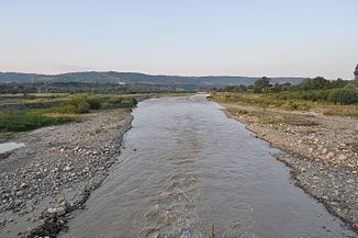 | ||
Putna River is a right tributary of the river Siret in Vrancea County in Romania, in the historical region of Moldavia. It discharges into the Siret near Vulturu.
Contents
- Map of Putna River Romania
- Hydrogeological features of the river basinEdit
- HydrographyEdit
- Towns and villagesEdit
- MapsEdit
- References
Map of Putna River, Romania
Hydrogeological features of the river basin.Edit
Hydrogeological studies reveal the presence of wide and relatively rich aquifers in all the structural zones of the river. The phreatic waters participate in proportion of 30% in supplying with water the surface water resources. Although rainfalls are the main element of water supply for the rivers, in the Vrancea Mountains area the groundwater supply has a great importance.
In certain conditions, the groundwaters contain salts, having a concentration of 0,5 g/l.
The river contains many minerals, especially sulphur, carbonates and iron compounds. Such mineral sources can be found at the foot of the slopes around the Putna Waterfall, at the foot of the northern slopes of Porcului Ridge (confluence of the Tişiţa and Putna rivers), on the valley of the Mișina River, at the river mouth of the Pietricica River.
HydrographyEdit
The river basin of the Putna River has a total surface of 2,480 km2 (960 sq mi); 31% of this surface is located in the mountain area, draining the eastern flank of the Vrancea Mountains. The mountainous basin of the Putna River is formed of two orohydrographic nodes. The most important is in the central sector of the western ridge of Vrancea Mountains, and is represented by the Lăcăuți-Arișoaia Ridge, out of which the Putna and the Zăbala rivers are spread radially. The second is individualized on the median ridge and is given by the northern extremity of Paisele Ridge, where the Năruja River and the little rivers belonging to the upper basins of the Putna, Tișița and Năruja rivers originate.
The total length of the Putna from its source to its confluence with the Siret is 153 km (95 mi). Its source is located on the northern slope of the Lăcăuți-Arișoaia ridge at altitude close to 1,700 m. From the source to the limit of the mountainous sector it has a length of 30 km, having a large semicircular shape, much to the north. The upstream sector is narrow, with a characteristic transversal profile, in "V" shape. After that, the valley widens as it traverses on about 9 km the Lepșa-Greșu depression. Downstream of Lepșa, Putna has splendid gorges, 7 km long, cut in sandstone, where it generates many slope breaks and, especially, the Putna Waterfall.
Tributaries include the Baba, Şipotu, Valea lui Ilie River, Stogu, Babovici, Pârâul Mărului, Greşu, Călinu, Slatina, Lepşa, Streiu, Mocearu, Deju, Caciu, Vidra, Vizăuți on the left side and Pârâul de sub Aristoaia, Pârâul Bradului Zburătura, Pârâul Țiganului, Cireșu, Tișița, Pârâul Porcului, Pârâul Câinelui, Carhagău, Coza, Văsui, Zăbala, Șoimu, Sturza, Milcov, Putna Seacă, Râmna on the right.
Towns and villagesEdit
The following towns and villages are situated along the river Putna, from source to mouth: Greșu, Lepșa, Tulnici, Negrilești, Bârsești, Valea Sării, Vidra, Garoafa, Vânători.