
Population 600 (2011 census) State electorate(s) Lockyer | Postcode(s) 4306 Postal code 4306 | |
 | ||
Purga Deebing HeightsGoolman | ||
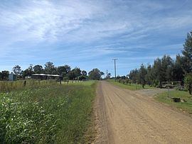
Purga is a rural community on the outskirts of Ipswich, Queensland, Australia. At the 2011 Australian Census, Purga and surrounding suburbs recorded a population of 600. The western boundary of Purga follows Warrill Creek.
Contents
Map of Purga QLD 4306, Australia
History
The area was named after the parish which was derived from the Aboriginal word pur-pur, meaning a meeting place. A railway station on the Dugandan railway line was opened in 1882. A primary school was opened in 1871 and closed in 1967.
Heritage listings
Purga has a number of heritage-listed sites, including:
References
Purga, Queensland Wikipedia(Text) CC BY-SA