
Elevation 289 ft (88 m) | ||
 | ||
Translation "Shallow Brook" (Natick Indian) Similar Col James Barrett Farm, Old North Bridge, Munroe Tavern, Wright's Tavern, Great Meadows National | ||
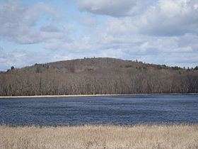
Punkatasset Hill is a hill located in Concord, Massachusetts. It is one of the highest points in the town at 289 feet (88 m).
Map of Punkatasset Hill, Concord, MA 01742, USA
The hill was originally known as Broad-topped Hill by the native Indians and was cultivated and farmed from the 17th century on.
In 1775, as the British troops marched into Concord, the Concord Minutemen took position atop Punkatasset Hill. On the hill they were met with reinforcements from the surrounding towns and the number of soldiers grew to at least 400. From their vantage point they saw the smoke of burning militia supply by the British from the center of Concord. Fearing it was their homes being burned, Colonel Barrett led his militia down to a hill only a few hundred yards from the Old North Bridge, and then to the Old North Bridge itself.
In the late 19th century, on clear days Concordians and visitors were treated to vistas of Boston, Mount Wachusett, and Mount Monadnock.
During the early 20th century, Punkatasset Hill was home to Concord's only ski slope. There was never a ski lift, but ski jumping contests were held there during the 1930s. Today the slope remains cleared, but not in use.
In 1971 the land was sold from private property to the town and converted to conservation land. Today Punkatasset Hill and the adjacent Estabrook Woods are popular hiking and walking destinations.