
 Similar Indo Gangetic Plain, North Bengal plains, Utkal Plains | ||
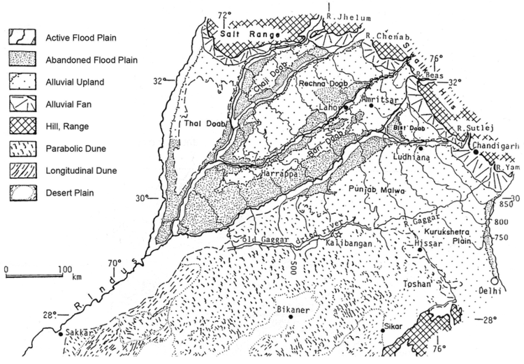
The Punjab Plain is an alluvial plain in Pakistan and the north-west of India. The plain includes the Pakistani province of Punjab and the Indian states of Punjab and Haryana and is around 35,000 square miles (91,000 km2) in area. This plain is around 200-300 meters high. The plain is extensively farmed for cereals and cotton.
The plain is the western part of the Northern Plain in Pakistan formed by the Indus River and its tributaries. The larger part of Punjab plain lies in Pakistan. The Indus and its tributaries, Jhelum, the Chenab, the Ravi, the Beas and the Satluj
The land formed of alluvium in between two rivers known as Doab are found here.
Bhangar : The flood plains formed due to deposition of older alluvium is known as Bhangar.
Bet : The flood plains seen here which are formed due to repeated deposition of new alluvium during each flood is known as Bet.