
Country Chile Province Aisén Climate Cfb Local time Wednesday 6:41 PM | Region Aisén Area 16,093 km² Area code 56 | |
 | ||
Weather 19°C, Wind SW at 5 km/h, 77% Humidity | ||
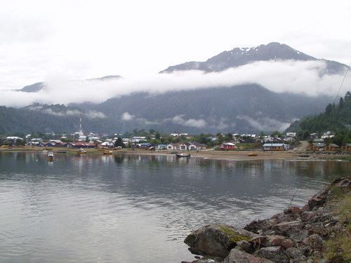
Puerto Cisnes (Spanish for: "port swans") is a town and seaport in Cisnes commune, Aysén Province, Aysén del General Carlos Ibáñez del Campo Region in the Chilean Patagonia. The town is located at the outflow of Cisnes River.
Map of Puerto Cisnes, Cisnes, XI Regi%C3%B3n, Chile
The town is located in the northwestern portion of the Aysén del General Carlos Ibáñez del Campo Region, an area that includes numerous islands, fjords and channels. The major island is Magdalena Island, which contains the national park that bears its name. Queulat National Park straddles the border between this commune and Lago Verde. Much of the commune area is covered with a lush vegetation and is divided by the Moraleda Channel. The main mountain of the area is Melimoyu volcano.
References
Puerto Cisnes Wikipedia(Text) CC BY-SA