
Elevation 15 m Local time Wednesday 2:33 PM | State Baja California Municipality Ensenada Municipality Population 41 (2010) | |
 | ||
Time zone Northwest US Pacific (UTC-8) Weather 26°C, Wind NE at 23 km/h, 28% Humidity | ||
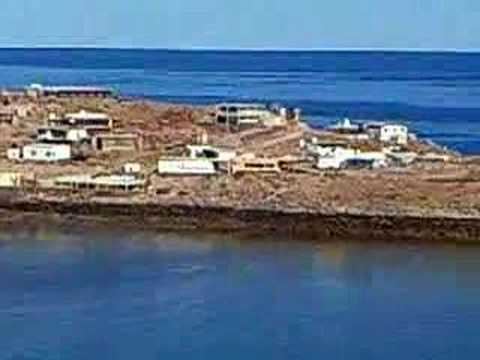
The town of Puertecitos is located 90 kilometers south of San Felipe, in the Mexican state of Baja California. Puertecitos is a tourist spot for both vacationers and expatriates from the United States. The Puertecitos bay, which was permanently settled in 1949 by Rafael Orozco, overlooks the Gulf of California. There are a couple of hundred homes and mobile homes in Puertecitos, mostly lying on a low hill which overlooks the Gulf of California on the east side, and the inner bay of Puertecitos on the west side.
Map of Puertecitos, Baja California, Mexico
Puertecitos receives an average of two inches of rain a year, and has the same climate as San Felipe.
Puertecitos is known primarily for its hot springs and being a tourist destination. There are no hotel accommodations and gas is not always available at the Puertecitos Pemex station. It is advisable to fill up with gas in San Felipe prior to driving to Puertecitos. There are many different places to camp. Bahia Cristina's, which is located 6.4 kilometres (4.0 mi) south has a restaurant. Bahia Encantada has no restaurant but it does have running water and a nice bay with calm water.
The best time to visit Puertecitos is in the spring or in autumn.