
Country United States County Linn FIPS code 20-57650 Elevation 270 m Population 262 (2013) Area code 913 | Time zone Central (CST) (UTC-6) GNIS ID 0478177 Zip code 66767 Local time Sunday 4:05 AM | |
 | ||
Weather 8°C, Wind W at 11 km/h, 93% Humidity Area 73 ha (67 ha Land / 5 ha Water) | ||
Prescott is a city in Linn County, Kansas, United States. As of the 2010 census, the city population was 264.
Contents
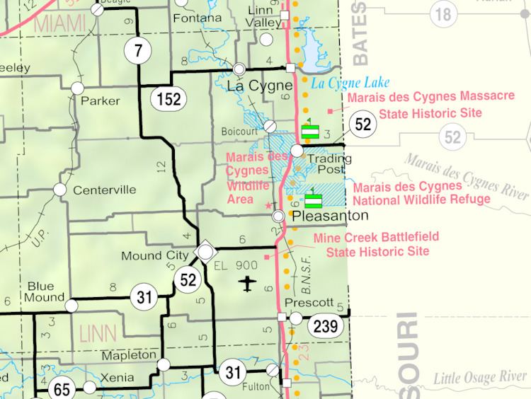
Map of Prescott, KS 66767, USA
History
Prescott was laid out in 1870. It was named for C. H. Prescott, a railroad official.
Geography
Prescott is located at 38°3′47″N 94°41′47″W (38.063063, -94.696339). According to the United States Census Bureau, the city has a total area of 0.28 square miles (0.73 km2), of which, 0.26 square miles (0.67 km2) is land and 0.02 square miles (0.05 km2) is water.
2010 census
As of the census of 2010, there were 264 people, 109 households, and 64 families residing in the city. The population density was 1,015.4 inhabitants per square mile (392.0/km2). There were 125 housing units at an average density of 480.8 per square mile (185.6/km2). The racial makeup of the city was 92.4% White, 0.8% African American, 2.3% Native American, 2.7% from other races, and 1.9% from two or more races. Hispanic or Latino of any race were 3.4% of the population.
There were 109 households of which 19.3% had children under the age of 18 living with them, 47.7% were married couples living together, 5.5% had a female householder with no husband present, 5.5% had a male householder with no wife present, and 41.3% were non-families. 36.7% of all households were made up of individuals and 15.6% had someone living alone who was 65 years of age or older. The average household size was 2.10 and the average family size was 2.66.
The median age in the city was 49.8 years. 17% of residents were under the age of 18; 5% were between the ages of 18 and 24; 20.1% were from 25 to 44; 28.3% were from 45 to 64; and 29.5% were 65 years of age or older. The gender makeup of the city was 49.2% male and 50.8% female.
2000 census
As of the census of 2000, there were 280 people, 109 households, and 58 families residing in the city. The population density was 1,207.0 people per square mile (470.0/km²). There were 124 housing units at an average density of 534.5 per square mile (208.2/km²). The racial makeup of the city was 99.29% White, 0.36% Native American and 0.36% Asian. Hispanic or Latino of any race were 2.14% of the population.
There were 109 households out of which 22.0% had children under the age of 18 living with them, 41.3% were married couples living together, 11.0% had a female householder with no husband present, and 45.9% were non-families. 43.1% of all households were made up of individuals and 25.7% had someone living alone who was 65 years of age or older. The average household size was 2.03 and the average family size was 2.78.
In the city, the population was spread out with 16.8% under the age of 18, 5.4% from 18 to 24, 17.9% from 25 to 44, 18.2% from 45 to 64, and 41.8% who were 65 years of age or older. The median age was 53 years. For every 100 females there were 77.2 males. For every 100 females age 18 and over, there were 72.6 males.
The median income for a household in the city was $23,462, and the median income for a family was $33,125. Males had a median income of $20,694 versus $31,875 for females. The per capita income for the city was $12,811. About 3.7% of families and 15.6% of the population were below the poverty line, including 11.8% of those under the age of eighteen and 16.9% of those sixty five or over.
Education
Prescott is served by Jayhawk USD 346. The district high school is Jayhawk-Linn High School.
Prescott High School was closed through school unification. The Prescott High School mascot was Hornets.