
Country United States GNIS feature ID 0766244 Area 204.6 km² Population 932 (2010) | FIPS code 29-59474 Elevation 236 m Local time Saturday 3:49 PM | |
 | ||
Weather 16°C, Wind E at 13 km/h, 86% Humidity | ||
Prairie Township is one of eight townships in Audrain County, Missouri, United States. As of the 2010 census, its population was 932.
Contents
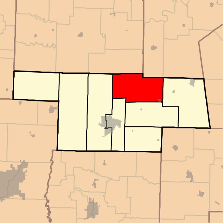
Map of Prairie Township, MO, USA
History
Prairie Township was established in 1837. The township was named for prairie landscape within its borders.
Geography
Prairie Township covers an area of 79.0 square miles (204.6 km2) and contains one incorporated settlement, Laddonia. It contains three cemeteries: Bean Creek, Eubank and Unity.
The streams of Bean Creek, Hazel Creek, Littleby Creek, Sandy Creek, Talleys Branch, Tattys Creek and Wildcat Creek run through this township.
Transportation
Prairie Township contains one airport or landing strip, Schlemmer Airport.
References
Prairie Township, Audrain County, Missouri Wikipedia(Text) CC BY-SA