
 | ||
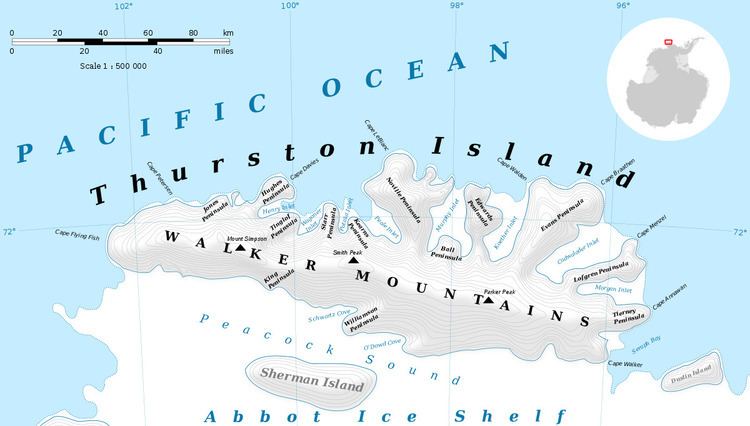
Potaka Inlet is a narrow ice-filled inlet about 8 nautical miles (15 km) long, indenting the north side of Thurston Island immediately east of Starr Peninsula. First delineated from air photos taken by U.S. Navy Operation Highjump in December 1946. Named by Advisory Committee on Antarctic Names (US-ACAN) for Dr. Louis H. Potaka, medical officer with the Byrd Antarctic Expedition, 1933-35.
Maps
References
Potaka Inlet Wikipedia(Text) CC BY-SA