
OS grid reference NB558373 Post town ISLE OF LEWIS Dialling code 01851 | Lieutenancy area Western Isles Sovereign state United Kingdom Local time Friday 5:04 PM | |
 | ||
Weather 10°C, Wind SW at 24 km/h, 72% Humidity | ||
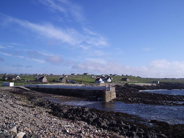
Portnaguran (Scottish Gaelic: Port nan Giùran) is a settlement situated within Point, on the Isle of Lewis, in the Outer Hebrides, Scotland. Portnaguran is the township at the north-easternmost point of the peninsula. It lies 1 mile (1.6 km) southwest of Tiumpan Head and just south of the headland called Geòdha 'ic Sheòrais or sometimes Small Head amongst locals. Portnaguran is situated at the north-eastern end of the A866, within the parish of Stornoway.
Map of Portnaguran, Isle of Lewis, UK
There is a small pier in the harbour, and the surrounding villages are Portvoller, Broker, Aird and Flesherin. The village itself is about 12 miles (20 km) from the town of Stornoway.
References
Portnaguran Wikipedia(Text) CC BY-SA