Rahul Sharma (Editor)

Port Island (Gdańsk)

Updated on
Edit
Like
Comment
Share on FacebookTweet on TwitterShare on LinkedInShare on Reddit
Port Island (Gdańsk) httpsuploadwikimediaorgwikipediacommonsthu

The Island (German: Die Nehrung) located between Gdańsk Bay, Śmiała Wisła and Leniwka. The area of the island belongs to the city of Gdańsk, Poland and is divided into 3 administrative quarters:

Contents

Map of Port Island, Poland

  • Stogi (Gdańsk) (Heubude), population 11,578, area 11.0 km², density 1,057
  • Przeróbką (Troyl), population 4,522, area 6.9 km², density 657
  • Krakowiec-Górki Zachodnie (Krakau & Westlich Neufähr), population 1,981, area 8.3 km², density 238
  • Total: population 18,081, area 26,2 km² (2013)

    IndustryEdit

    The Island is very important industrial strip. Gdańsk refinery is located there, together with many facilities of the Gdańsk Port.
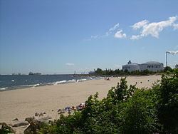
    SightseeingEdit

  • Wisłoujście, 17th-century fortress that used to guard the mouth of the Gdańsk Port.
  • Westerplatte, the place where the Second World War started, is also located there.
  • References

    Port Island (Gdańsk) Wikipedia