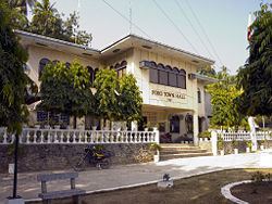
Country Philippines Founded 17 December 1701 Time zone PHT (UTC+8) Province Cebu | District 5th district of Cebu Barangay Area 63.59 km² | |
 | ||
Region Central Visayas (Region VII) Neighborhoods Pagsa, Teguis, Western Poblacion, Paz, San Jose | ||
Poro is a 4th municipal income class municipality on Camotes Islands in the province of Cebu, Philippines. According to the 2015 census, it has a population of 25,212. In the 2016 electoral roll, it had 13,790 registered voters.
Contents
Map of Poro, Cebu, Philippines
Poro, along with the municipality of Tudela, is located on Poro Island of the Camotes Islands.
The patronal feast of Poro is celebrated on the third Friday of January, in honour of the Santo Niño de Cebu.
Barangays
Poro comprises 17 barangays:
Demographics
In the 2016 electoral roll, it had 13,790 registered voters, meaning that 55% of the population are aged 18 and over.
Etymology and languages
The town's name is derived from the Waray-Waray word puro meaning "island". This how Camotes Island is called by Warays and Leyteños. Before the first municipality to be established in Camotes, puro meant the name of all the islands.
Aside from Visayan languages, Filipino, and English, the townsfolk also speak the local Porohanon language. Also known as Camotes Visayan, the language is mutually intelligible with other Visayan languages (e.g. Cebuano) spoken in the rest of the Camotes Islands, Cebu, other parts of the Visayas, and Northern Mindanao.
Porohanon is distinguished by the way the locals substitute /j/ sounds with /ʒ/, for instance Cebuano maayong buntag ("good morning") vocalised as maazong buntag in Porohanon. (Possibly occasions too a handover from the yeísmo phenomenon in Spanish.) Other dialectical variations include the Porohanon ara dira instead of the standard Cebuano na-a diha.
