
 | ||
Porcupine Bank is an area of the Irish shelf, on the fringes of the Atlantic Ocean approximately 200 kilometres (120 mi) west of Ireland. The relatively raised area of seabed, 200 m below sea level at its highest, lies between the deep-water Porcupine Seabight and Rockall Trough.
Map of Porcupine Bank
The name comes from the bank's discovery in 1862 by HMS Porcupine, a British sail and paddle-wheel ship used mainly for surveying.
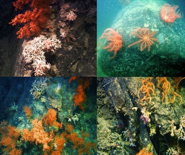
The northern and western slopes of the bank feature species of cold-water corals.
According to Dr. Anthony Grehan of the National University of Ireland, Galway, the virtually untouched site could benefit dwindling fish stocks and possibly aid medical research.
"These are by far the most pristine, thriving and hence spectacular examples of cold-water coral reefs that I’ve encountered in almost ten years of study in Irish waters. There is also evidence of recent recruitment of corals and many other reef animals in the area suggesting this area is an important source of larvae supply to other areas further along the Porcupine Bank."
In an 1870 paper presented to the Geological Society of Ireland, Mr W Fraser suggested that these reefs mark the site of the sunken island of Hy-Brasil. Hy-Brasil was recorded on maps of the 15th and 16th centuries and is sometimes referred to as the other Atlantis.