
Basin size 59 km (23 sq mi) Basin area 59 km² | Length 15 km | |
 | ||
Main source Ligurian Alps1,000 m (3,300 ft) River mouth | ||
The Pora (or Porra) is a 15-kilometre (9.3 mi) stream of Liguria (Italy).
Contents
Map of Torrente Pora, Province of Savona, Italy
Geography
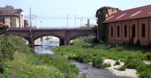
The river rises at around 1000 m in the Ligurian Alps, not faraway from Colle del Melogno, at the jonction between rio Rivase and Rio Peccione, in the comune of Rialto. Flowing in the Valle Pora it passes through the comune of Calice Ligure, where it receives from left the waters of torrente Carbuta. Heading south-east the Pora reaches Finlaborgo and gets its main tributary, torrente Aquila; a couple of km downstream it ends its course in the Ligurian Sea, after being crossed by the Genoa–Ventimiglia railway and the Aurelia national road.
Pora basin (59 km2) is totally included in the Province of Savona
Main tributaries
References
Pora (river) Wikipedia(Text) CC BY-SA