
Length 1,000 m | Area 500 ha | |
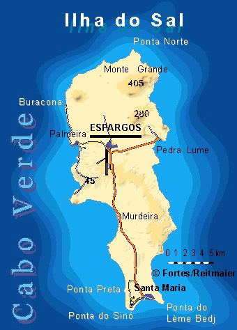 | ||
Location Southern Sal, Cape Verde | ||
Ponta Preta, as there is one in the north of Sal, it is sometimes known as Ponta Preta do Sul is a headland in the southwest of the island of Sal in Cape Verde. It is about 2 km west of the town Santa Maria and about 1 km of Ponta do Sinó and its lighthouse. It also has its beach named Praia da Ponta Preta which covers 3 km of the southwesternmost coastline and is about 100 to 200 meters and around 300 meter at the headland, it strecthes up to the vicinity of Ribeira do Algodeiro and its tiny settlement. Praia de Santa Maria is its nearest beaches bordering near the southernmost point of the island.
The etymology of the name is Portuguese meaning black tip, hence its brown to black colored rocks founded when the point was named, also its bushes and grasses that are colored brown or black.
In 2003, the southernmost part of the beach had built hotels in the area and some of them were completed as early as 2005.
In around 2007 and 2009, new hotels, resorts and villas had been developed and a secondary road was completed and with a few roundabouts connects the road connecting the town and Ponta do Sinó and the Espargos-Santa Maria Road. Desert sands and bushes remain in the mid portion of the area of the point.