
Time zone PETT (UTC+12:00) | Population (2002 Census) 0 inhabitants Local time Thursday 10:42 PM | |
 | ||
Weather -14°C, Wind SW at 6 km/h, 82% Humidity | ||
Polyarny (Russian: Полярный) was an urban locality (an urban-type settlement) in Shmidtovsky District (now merged into Iultinsky District of Chukotka Autonomous Okrug, Russia, about 90 kilometers (56 mi) west of Mys Shmidta. Population: 0 (2002 Census); 4,678 (1989 Census).
Contents
Map of Polyarny, Chukotka Autonomous Okrug, Russia, 689380
History
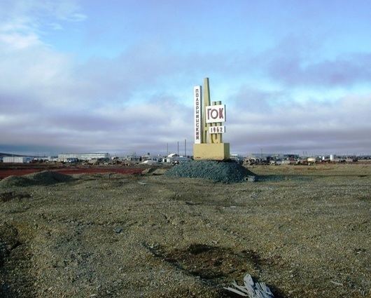
The settlement was specifically established to house miners working in the nearby goldmines.
In 1961, geologists working in the Pilkhinkuul river valley found a large gold deposit. On March 26, 1963 decree number 104 of the Northeastern Economic Council announced an official decision on the creation of a mine to be named "Polyarny" and a camp of the same name. The first convoy of 15 tractors brought equipment, building materials and everything needed to create the mine and the village. Despite the difficult conditions construction was rapid. The settlement was constructed in three locations: in the centre two-storeyed well-appointed homes and general social infrastructure were built. On the southern outskirts of the settlement, a more private sector was constructed, which became commonly known as "Shanghai" (Russian: Шанхай). This was also the site of a number of wooden houses with few amenities. Finally, in the northern part of the settlement production units were constructed along with a small residential area, which became known as "Bichgrad" (Russian: Бичгра́д), mostly consisting of single-story barracks. Because of its relative remoteness from the main part of the settlement a bus route was organised to the high school in 1975. In the north-eastern part of the village was a base of geologists with the residential area, which was known colloquially as "Exploration" (Russian: Разведка). At the end of the 1980s additional construction of residential buildings began, where people began to move from deplorable housing, where they had been living without repair since the foundation of the settlement. In accordance with the direction of the prevailing wind almost all the houses were oriented from east to west when they were constructed, and because of the permafrost layer, strong foundations were laid and no construction was undertaken higher than two storeys.
When mining became unprofitable, a law was passed in May 1995, abolishing the settlement; it was abolished in 1995. Polyarny had a population of around four thousand during the 1980s, but, as can be seen from the table below, once the mines were closed and the village liquidated, it became a ghost town.
In the early 1990s, the level of gold deposits in the Polyarny mines dwindled and more modern methods of extraction were required in order for the area to remain profitable.
Air
From 1969 air transport was provided on a regular basis, using a dirt runway 450 m in length, located half a mile from the village. Passenger and mail transport was available to destinations across the district and to Pevek. Weather conditions often disrupted flights for several days or even weeks. In 1991, several years before the settlement was formally liquidated, air transport ceased.
Road
Polyarny was only ever connected by road to the neighbouring settlement of Leningradsky, also a settlement established specifically for mining. There was however, a small network of roads within the area, including:
Climate
Polyarny has a Tundra climate (ET) because the warmest month has an average temperature between 0 °C (32 °F) and 10 °C (50 °F).