
INSEE/Postal code 39434 /39800 Population 4,318 (2006) | Time zone CET (UTC+1) Area 50.22 km² Local time Thursday 2:08 AM | |
 | ||
Region Bourgogne-Franche-Comté Weather 8°C, Wind E at 13 km/h, 78% Humidity | ||
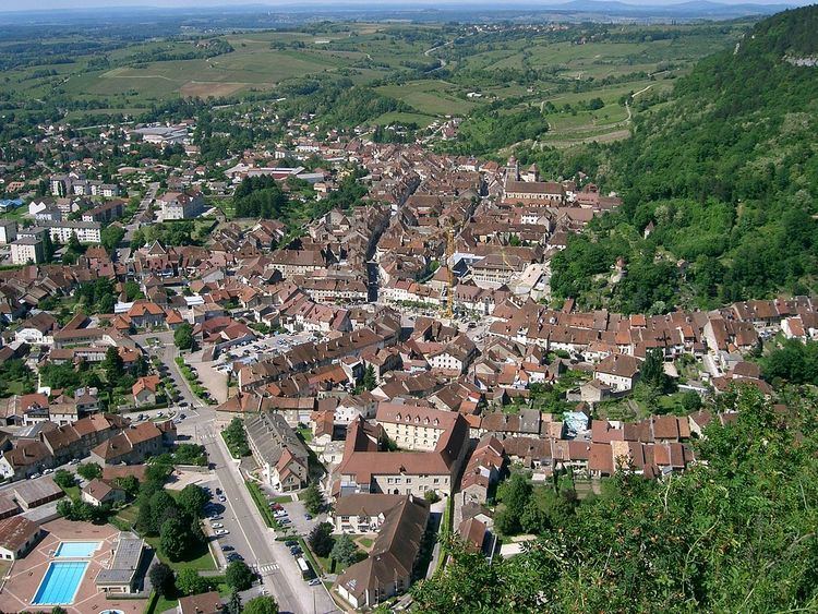
Poligny is a commune in the Jura department in Franche-Comté in eastern France.
Map of Poligny, France
The town stands on the edge of the first plateau of the Jura region, with limestone cliffs rising to its east and south, and a steephead valley leading to the village of Vaux-sur-Poligny to the east. On the cliffs to the east is a notable cave, known as "Le Trou de la Lune" (the Moonhole); on the cliffs to the south is a large cross, the "Croix du Dan". A network of hiking trails surrounds the town and provide routes to both these viewpoints, and the GR 59 long distance footpath runs through the town.
First Empire general Jean-Pierre Travot was born in Poligny; a statue in his honour stands in the principal square of the town, the Place des Déportés, and a road is named after him.
Poligny is served by the railway line from Besançon to Lons-le-Saunier.