
Country Canada RCM Manicouagan Time zone EST (UTC−5) Area 111.4 km² | Region Côte-Nord Constituted January 1, 1964 Postal code(s) G0H 1M0 Province Québec | |
 | ||
Pointe-aux-Outardes is a village municipality in Quebec, Canada, on the southern point of the Manicouagan Peninsula between the mouths of the Outardes and Manicouagan Rivers.
Contents
Map of Pointe-aux-Outardes, QC, Canada
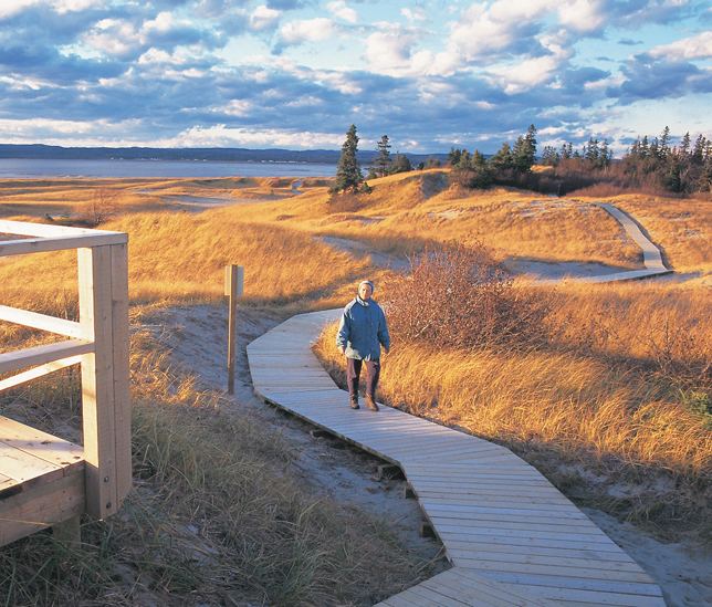
The place is named after a piece of land that juts out into the Saint Lawrence River and partially encloses the Outardes Bay: Pointe aux Outardes. It literally means "Point of Bustards", but Outarde can also be translated as "Canada goose". In fact, Canada geese and snow geese use the nearby Manicouagan River as a corridor in their annual migration and stopover at the point. The Innu called it Piletipistu Neshkâu, meaning "point of the Partridge River". But the term Outardes was used on Guérard's map of 1631 and on Franquelin's map of 1685 to identify the river that flows past the point into the St. Lawrence.
Pointe-aux-Outardes is exceptionally rich in flora and fauna. Among its salt marshes, more than 175 species of birds have been counted.
Demographics
Population trend:
Private dwellings occupied by usual residents: 562 (total dwellings: 604)
Mother tongue: