
County Grant ZIP code 46928 Elevation 268 m Population 91 (2010) | State Indiana FIPS code 18-60894 Area 8.8 km² Local time Wednesday 12:38 PM | |
 | ||
Weather -1°C, Wind E at 19 km/h, 56% Humidity | ||
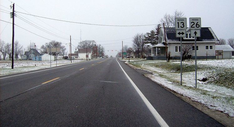
Point Isabel is an unincorporated community and census-designated place (CDP) in central Green Township, Grant County, Indiana, United States. It lies at the intersection of State Roads 13 and 26. As of the 2010 census it had a population of 91.
Contents
Map of Point Isabel, IN 46928, USA
A post office was established at Point Isabel in 1859, and remained in operation until it was discontinued in 1911.
Geography
Point Isabel is located in southwestern Grant County at 40°25′18″N 85°49′28″W. State Road 13 leads north 6 miles (10 km) to Swayzee and south 10 miles (16 km) to Elwood, while State Road 26 leads east 9 miles (14 km) to Fairmount and west 16 miles (26 km) to the southern outskirts of Kokomo. Marion, the Grant County seat, is 15 miles (24 km) to the northeast via State Roads 26 and 37.
Education
Residents are in the Madison-Grant United School Corporation. Madison-Grant High School is the zoned high school.