
Elevation 627 m Population 79 (2011) | Postal code 391 42 Area 3.57 km² | |
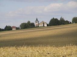 | ||
Pohnání is a village and municipality (obec) in Tábor District in the South Bohemian Region of the Czech Republic.
Map of 391 43 Pohn%C3%A1n%C3%AD, Czechia
The municipality covers an area of 3.57 square kilometres (1.38 sq mi), and has a population of 80 (as at 3 July 2006).
Pohnání lies approximately 14 kilometres (9 mi) north-east of Tábor, 61 km (38 mi) north-east of České Budějovice, and 74 km (46 mi) south-east of Prague.
References
Pohnání Wikipedia(Text) CC BY-SA